(Part 5)

100 Days Journey: Part 5 – Guiding Death Valley
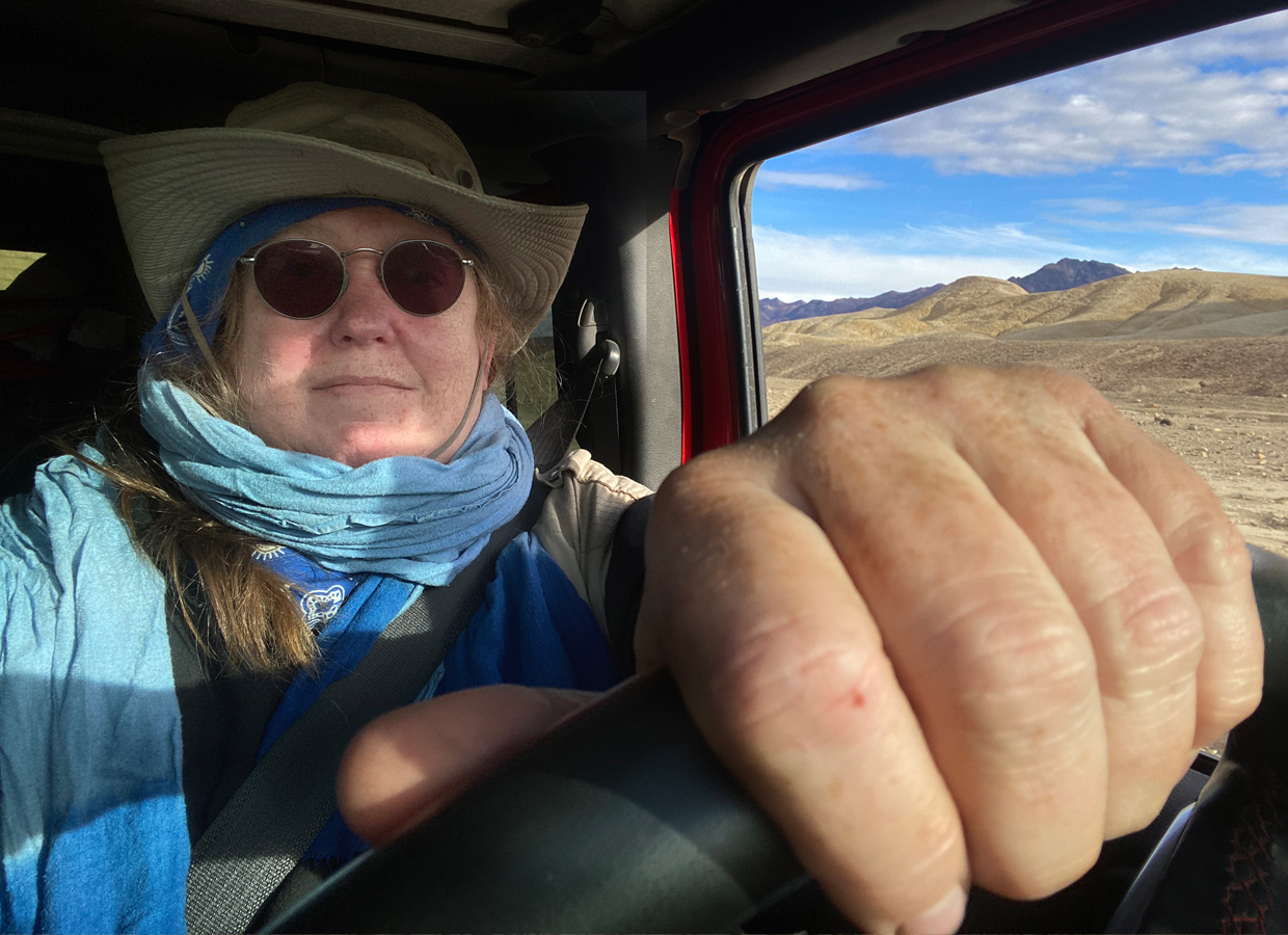
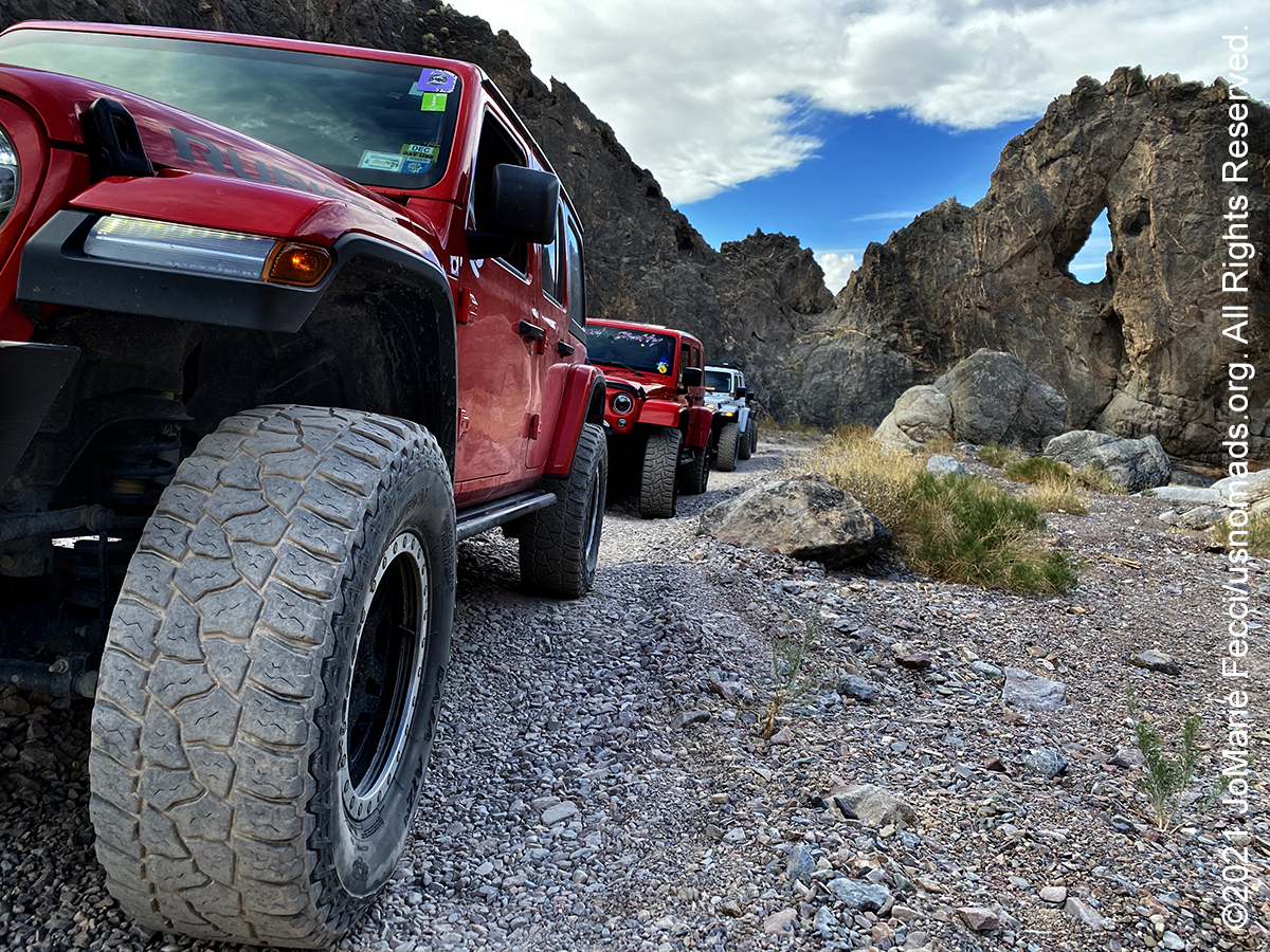
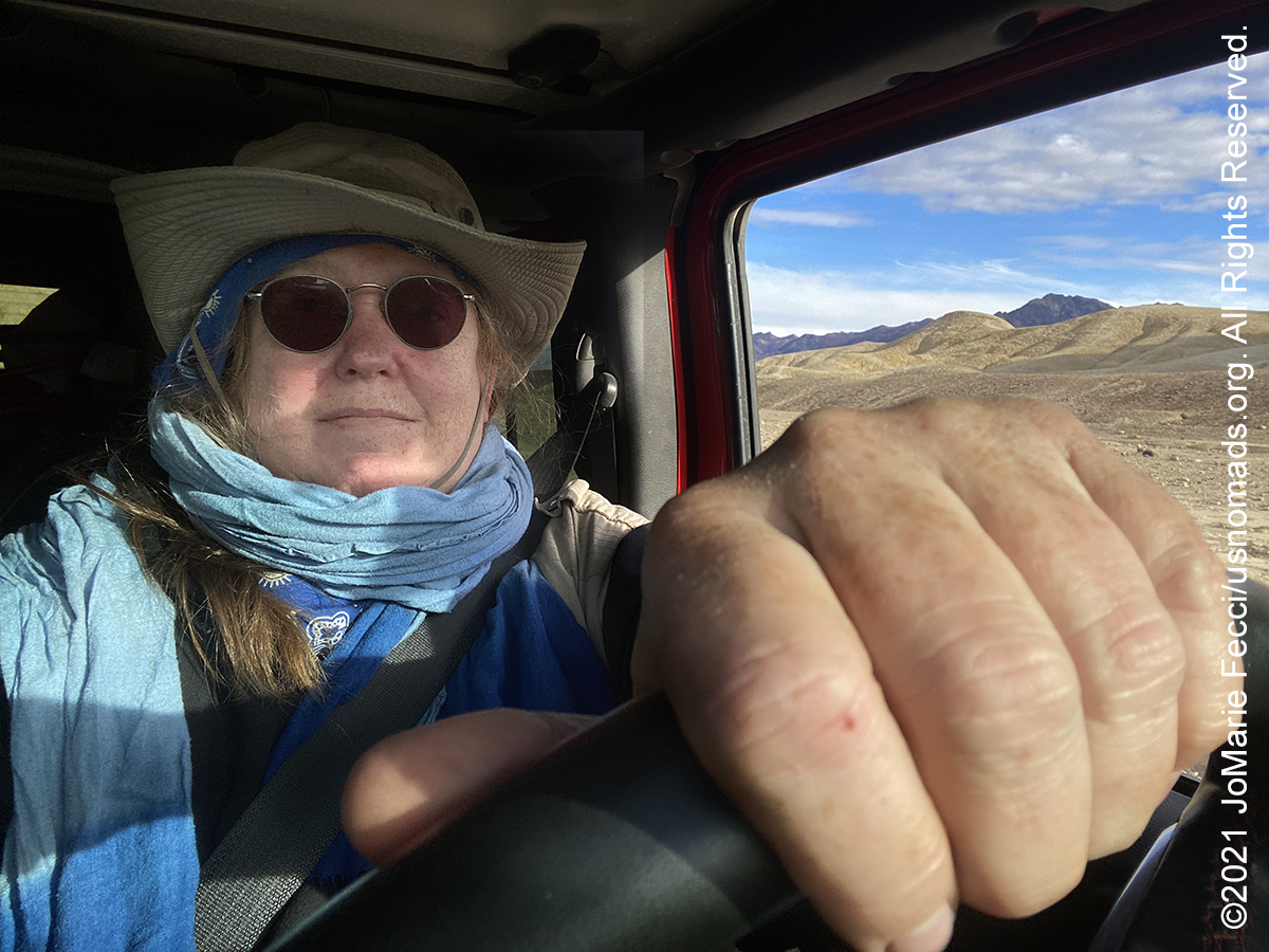
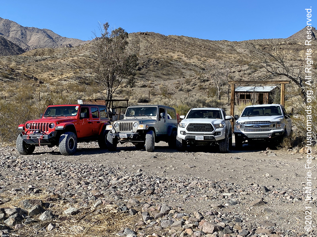
Back to Death Valley to serve as a trail guide for the California 4WD Association’s inaugural Death Valley Experience event. The DVE is a week of camping and Jeep trails that cover a range of Death Valley locations, and the guided drives include historical narrative en route. The trails range from easy scenic drives to long all-day routes with obstacles and navigational challenges. (Click through the images below for each day’s notes)…
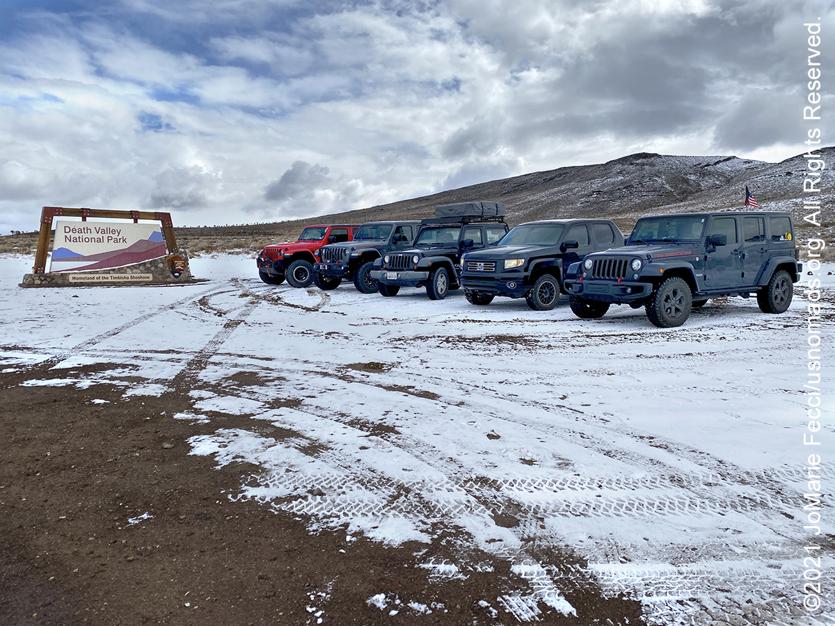
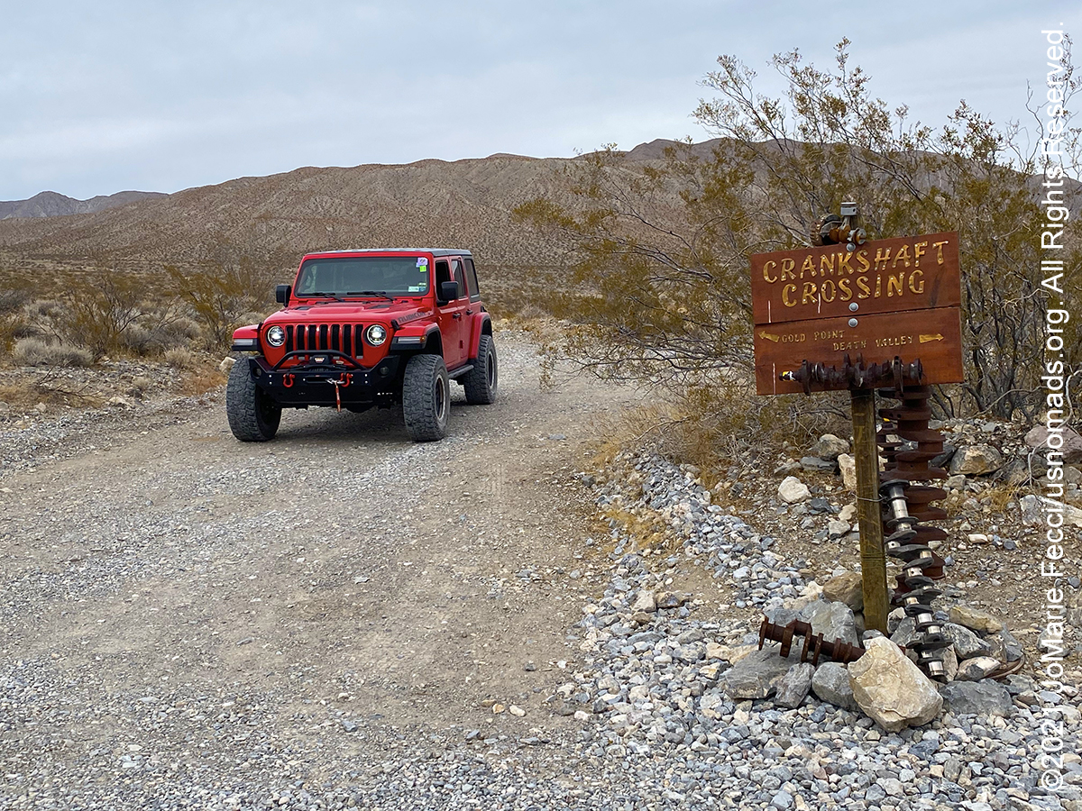
Note this map provides an overview of the fifth segment of the journey–covering the trail routes and locations around Death Valley, and the return to Las Vegas. The route on this map shows the overall direction of travel and key “stops” but does not include any detailed GPX tracks for backcountry trails, etc…
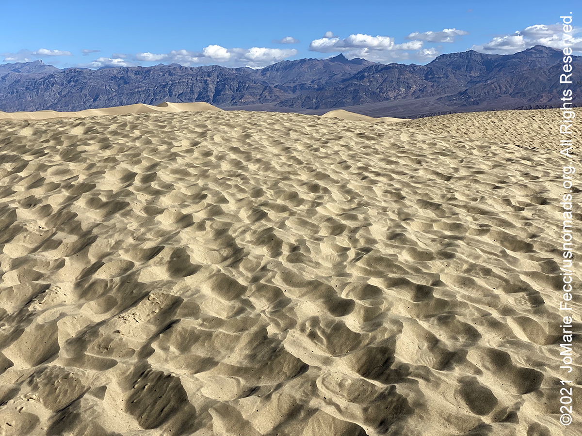
Death Valley National Park is the largest national park outside of Alaska. Near the border of California and Nevada, in the Great Basin, east of the Sierra Nevada mountains, Death Valley is the principal feature of the Mojave and Colorado Deserts Biosphere Reserve. This desert valley is one of the hottest places in the world. It is a landscape of extremes. With over 3 million acres of federally designated Wilderness it is possible to walk along majestic sand dunes, navigate twisted slot canyons, climb rocky peaks and stroll along salt flats. The variety of terrains offer everything from easy to very challenging adventures. The Grapevine Mountains and the Owlshead Mountains form its northern and southern boundaries, respectively, and the valley sits between the Amargosa Range on the east and the Panamint Range on the west. Badwater Basin, at 282 feet below sea level, is the point of the lowest elevation in North America.
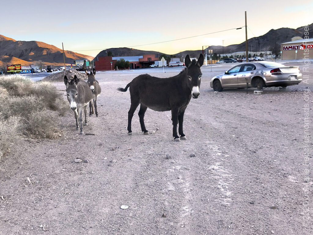
Beatty is a town along U.S. Route 95 between Tonopah to the north and Las Vegas to the south. It is a “gateway” to Death Valley National Park, which sits about 8 miles to the west. The town was eEstablished in 1905 and named after Montillus (Montillion) Murray “Old Man” Beatty, who settled on a ranch in the Oasis Valley in 1896 and became Beatty’s first postmaster. With the arrival of the Las Vegas and Tonopah Railroad in 1905, the town became a railway center for the Bullfrog Mining District, including mining towns such as nearby Rhyolite. Starting in the 1940s, Nellis Air Force Base and other federal installations contributed to the town’s economy as did tourism related to Death Valley National Park and the rise of Las Vegas as an entertainment center. Today most Beatty businesses cater to tourist travel. The town has a quirky vibe is also known for the wild burros that roam the streets. Beatty has long embraced its resident donkeys, which serve as living symbols of the community’s roots as an early 20th-century mining camp. The town used to hold annual “burros races,” in which competitors would lead the uncooperative animals to make-shift campsites and cook them flapjacks.
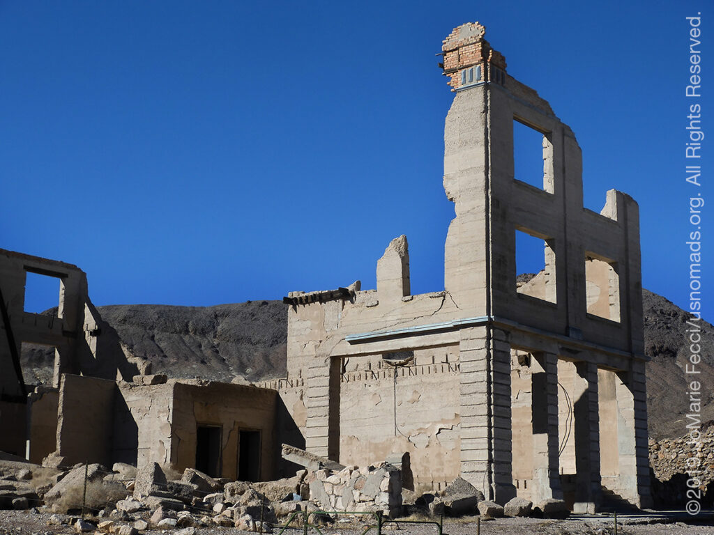
Rhyolite is a ghost town in the Bullfrog Hills, near the eastern boundary of Death Valley National Park. The town began in early 1905 as one of several mining camps that sprang up after a prospecting discovery in the surrounding hills. During an ensuing gold rush, thousands of gold-seekers, developers, miners and service providers flocked to the Bullfrog Mining District. Many settled in Rhyolite, which lay in a sheltered desert basin near the region’s biggest producer, the Montgomery Shoshone Mine. By 1907, Rhyolite had electric lights, water mains, telephones, newspapers, a hospital, a school, an opera house, and a stock exchange. Published estimates of the town’s peak population vary widely, but scholarly sources generally place it in a range between 3,500 and 5,000 in 1907–08. Rhyolite declined almost as rapidly as it rose. After the richest ore was exhausted, production fell. By the end of 1910, the mine was operating at a loss, and it closed in 1911. By this time, many out-of-work miners had moved elsewhere, and Rhyolite’s population dropped well below 1,000. By 1920, it was close to zero. After 1920, Rhyolite and its ruins became a tourist attraction and a setting for motion pictures. The ghost town is on property overseen by the Bureau of Land Management.
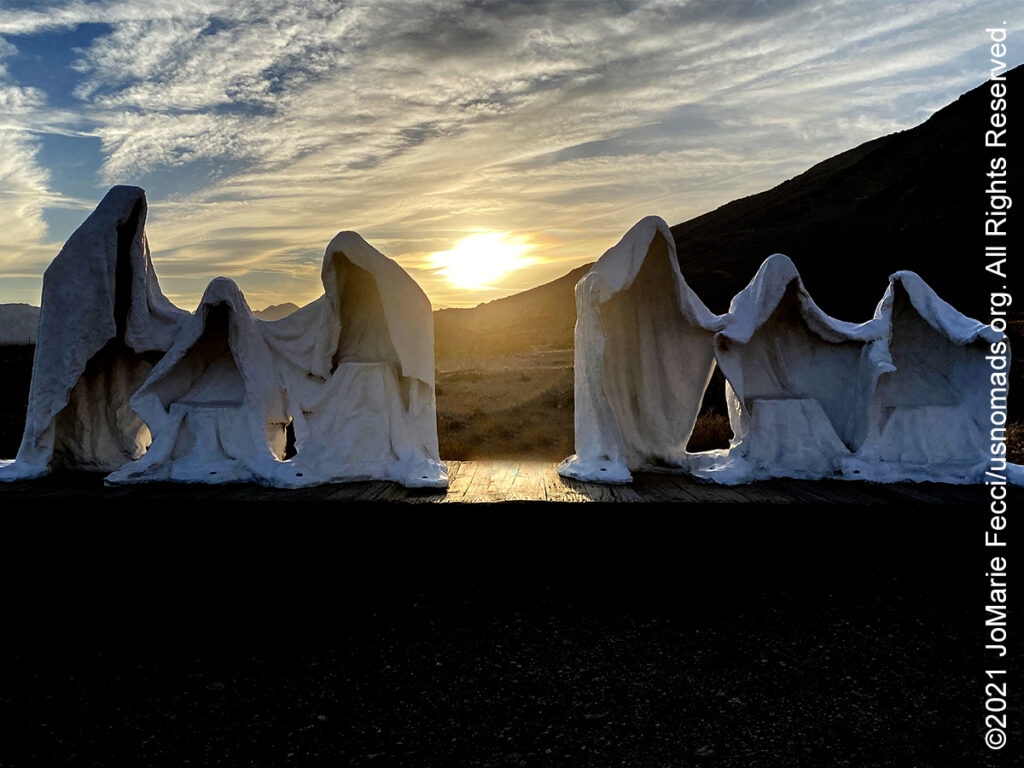
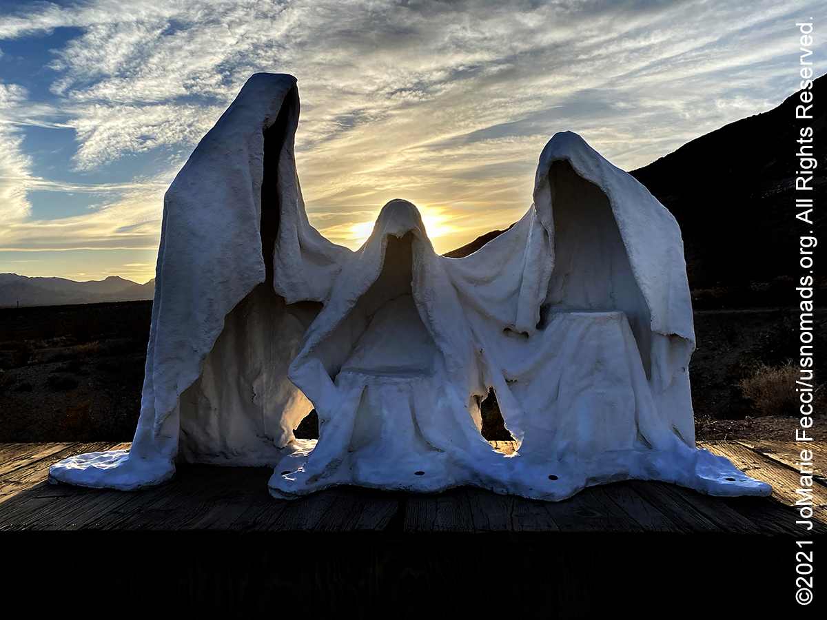
The Goldwell Open Air Museum is located just south of the ghosttown of Rhyolite. The “museum” created by a group of prominent Belgian artists, led by the late Albert Szukalski, consists of a set of outdoor sculptures that are colossal not only in their scale but in their placement within the vast upper Mojave desert. Known for many years in Europe as the sculptor of “ghosts” & a “situation maker”, Albert Szukalski came to the Nevada desert in 1984 to create what is perhaps the most unique piece of his career. Originally designed to endure a mere two years, “The Last Supper” sculpture has not only stood the test of time, but has lived on to become the “genesis” piece of the Goldwell Open Air Museum. Albert was attracted to the Mojave Desert for many reasons, not the least of which was the Mojave’s resemblance to the deserts of the Middle East. To construct a modern day representation of Christ’s Last Supper, especially so close to Death Valley (where he originally wanted it sited), is eerily appropriate. Working essentially from Leonardo Da Vinci’s fresco of the Last Supper within the desert environment, Szukalski succeeded in blending the two disparate elements into a unified whole. Maintaining the staging of the figures in Leonardo’s work and placing it in the American Southwest allowed the artist to meld Western Artistic tradition with the vast landscape of the New World. Albert Szukalski followed up “The Last Supper” with two other pieces at the site, “Ghost Rider” in 1984 and “Desert Flower” in 1989. “Desert Flower” was destroyed in a windstorm in 2007.
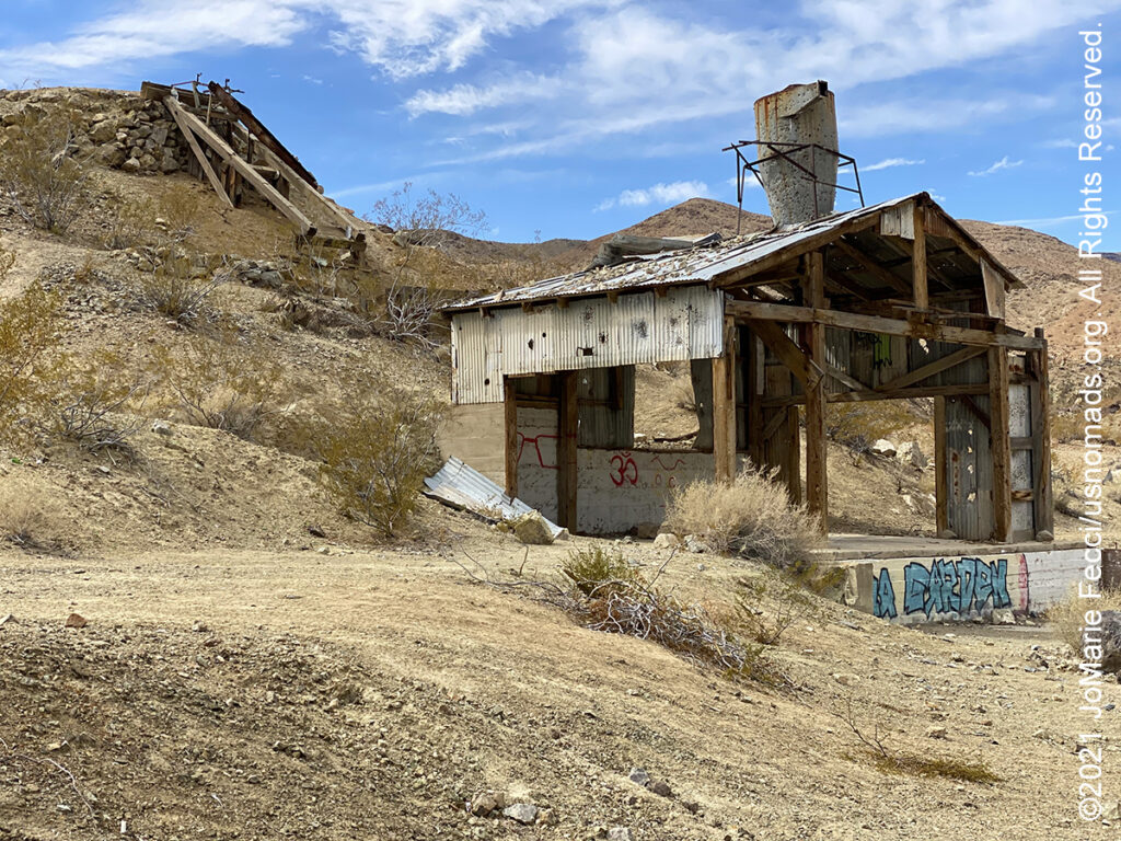
Echo Canyon is a jeep trail that starts 2 miles east of Furnace Creek Inn on Hwy 190. From the pavement the road runs northeast along the base of a low hill, then continues across the broad, open bajada towards the mouth of Echo Canyon in the distance. Dispersed camping is allowed after the first two miles, but campfires are not permitted. The trail is generally easy, but it gets more rocky 3 miles from the highway. The Needle’s Eye, a natural arch, is located within the canyon narrows. The arch looks like a hole in a thin fin of rock that juts out into the canyon forming a tight gooseneck turn. The trail curves east and continues up a broad valley with scattered mines and prospects on both sides. The main trail leads to the Inyo Mine. At the mine site there are the remains of several buildings, mine tailings and additional structures. The trail is typically run as an “out-and-back” route from the highway to the Inyo Mine. To do the trail all the way through to the Nevada side requires a short wheelbase 4×4 and an experienced driver due to the “waterfall” rock obstacle. That route takes a side road that climbs over a small saddle leading to Lee’s Camp and the Amargosa Valley.
Father Crowley Point, located near the western park boundary, was a favorite stopping place for travelers, long before the creation of Death Valley National Park. One of those travelers was Father John J. Crowley, a catholic priest responsible for ministering to the people of Inyo County Parish in the 1930s.The Desert Padre, as he was known, would often stop here to admire the views on his way to or from visiting parishioners in Death Valley, and his home in Lone Pine, CA. The overview at the vista point named for the padre offers a stunning view into Rainbow Canyon, a colorfully striped canyon created by ancient volcanic activity. A short ¼ mile walk or drive on an unpaved road leads to an overlook down across the whole Panamint Valley. In recent years, Rainbow Canyon has been nicknamed “Star Wars Canyon” by visitors who came to observe the military test flights which occur in the vicinity. Star Wars Canyon is part of the R-2508 Complex, which has been used by the military since the 1930s. The test flights were temporarily suspended in 2019 after a fatal accident involving the crash of a F/A-18 Super Hornet.
Darwin, a semi-ghosttown on the western outskirts of Death Valley, was once the largest city in the county. The settlement got its start in early 1860 when a prospecting expedition led by Dr. E. Darwin French set out from Visalia, California in search of the Lost Gunsight Mine. Exploring the rocky, dry landscape southeast of Owens Lake, French’s party never found the Lost Gunsight Mine, but they did discover rich silver outcrops and staked a number of claims. The settlement of Darwin was soon established and quickly developed into the main commercial center in the area. By the end of 1875, Darwin boasted two smelters, some 20 operating mines, a post office, graded streets, a drug store, hotel, three restaurants, a few saloons, a newspaper, 200 frame houses, and more than 700 residents. Because of its isolation, and distance from the county seat of Independence, gunplay, assaults, and stage robberies were common. Still, the town continued to grow, peaking at a population of about 3,500 in 1877. However, the following year a smallpox epidemic swept the community and a national economic slowdown hit Darwin hard. During the early 1900s, demand for copper reinvigorated the mining industry and by June 1919 the Darwin District, was again going strong. The mines remained in operation until the 1970s. Today, Darwin’s population is estimated at just about 50 people. On the hillside of Mt. Ophir, about ½ northwest of “downtown,” can still be seen the remains of the company camp, including decaying rows of company houses as well as Quonset huts and mill buildings. The mine is privately owned and not currently in operation. “No Trespassing” signs posted along the mine’s perimeter advise curious passerbys to stay off the property.
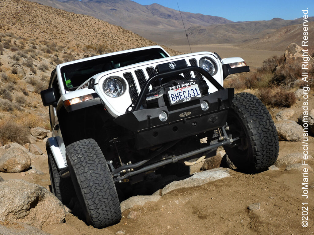
Mengel Pass is a mountain pass at an elevation of 1.314m above sea level located in the Death Valley National Park. The pass links Panamint Valley on the west end of Death Valley with Butte Valley on the east side. It is part of a favorite Jeep trail in Death Valley that leads to the Barker Ranch site where Charles Manson was captured by police. The pass is named after Carl Mengel, a historic prospector from the early 20th century. At the summit is a memorial monument of stacked rocks. Mengel settled in the area of Butte Valley and bought a mine claim in Goler Wash in 1912. He is said to have lost a leg in a mining accident but continued mining and living in the area for the rest of his days. Mengel died in 1944 and his ashes and prosthetic leg are said to be buried beneath the stone cairn. The road to the summit is a long, but scenic trail, and is generally easy driving, though there are heavily washboarded sections and some spots may be steep and rutted. The only really challenging part is on the pass itself which has some deep ruts and steep rock steps in a narrow tight spot.
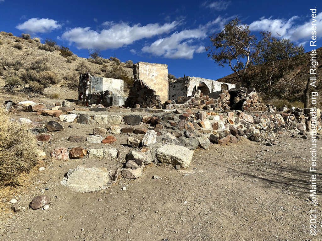
The Barker Ranch, located inside Death Valley National Park, is infamous due to its association with Charles Manson and his “family”. It is accessible only by primitive and rugged roads. Bluch and Helen Thomason began construction of Barker Ranch around 1940. It was originally used as a storage and shop facility to support their mining activity in the area. The Barker family bought the property in 1956, and expanded the cabin into a larger house. In 1968, Charles Manson learned about the Barker Ranch and relocated his “family” there. Once the Mansons moved in, the ranch became one of the locations from which they planned a series of murders in an attempt to start an apocalyptic race-war, his “Helter Skelter.” But as Manson orchestrated the killings of nine people, his followers also conducted raids in Death Valley stealing dune buggies and vandalizing National Park property. It was these relatively petty crimes, not the murders, that led to the Manson family’s arrest. In 1969, a joint force of National Park rangers, California Highway Patrol and Inyo County Sheriff’s officers burst into Barker Ranch and dragged a crazed Swastika-tattooed man out from under a bathroom vanity. At the time they thought they were nabbing a group of local troublemakers, they were completely unaware that they had a mass-murder suspect and his followers. In 1976, the ranch became part of the California Desert Conservation Area. In 1994, it was incorporated into Death Valley National Park.