(Part 3)

100 Days Journey: Part 3 – Mojave Road to Alabama Hills
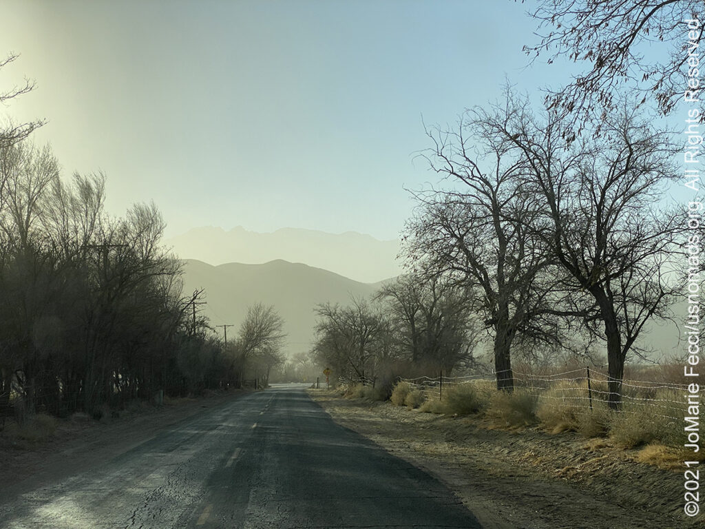
Setting out on the iconic Mojave Road in search of some solitude and deep desert vibes before continuing north and west towards the surreal landscapes of the Trona Pinnacles and the Alabama Hills beyond. This segment of the journey is all about wilderness, solitude and self-reliance. (Click through the images below for each day’s notes)…

Note this map provides an overview of the third segment of the journey–from the start of the Mojave Road in Nevada, across the California desert route to the Barstow area before turning north to the Trona Pinnacles and the Alabama Hills, then returning to Arizona via historic Route 66. The route on this map shows the overall direction of travel and key “stops” but does not include any detailed GPX tracks for backcountry trails, etc…
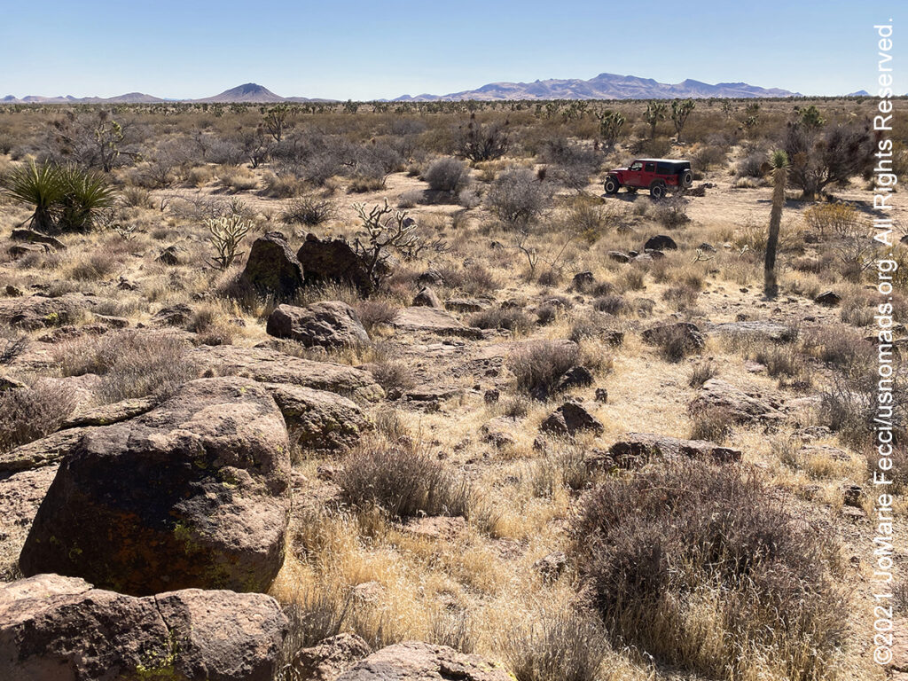
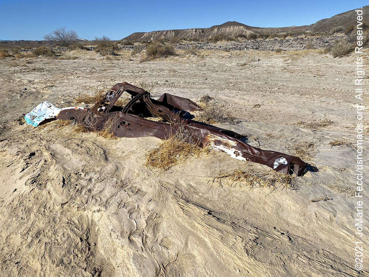
The Mojave Road is an east-west route, roughly 150 miles long, that traverses the desert between the Colorado River and the Mojave River near Wilmington, Los Angeles, CA. Most of the Mojave Road is within the boundaries of the Mojave National Preserve. Also known as Old Government Road or the Mojave Trail, it is a historic route stretching 147 miles from Beale’s Crossing (the river crossing site on the west bank of the Colorado River, opposite old Fort Mojave, roughly 10 miles southwest of Bullhead City, Arizona), to Fork of the Road along the north bank of the Mojave River where the old Mojave Road split off from the route of the Old Spanish Trail/Mormon Road. A traditional thoroughfare of desert-dwelling Native Americans, the Mojave Trail much later served Spanish missionaries, explorers, and foreign colonizers and settlers from the 18th to 19th centuries. The route ran between watering holes across the Mojave Desert from the Colorado River to the Mojave River then following it to the Cajon Pass, the gap between the San Bernardino Mountains and San Gabriel Mountains, into Southern California ending at Drum Barracks. The watering holes recur at intervals of about 60 miles to 70 miles. Over time military forts were established along the route to protect the water sources and provide assistance for travelers. The land had been taken from Mexico by the US in 1848 following the Mexican–American War and the Mojave Trail became part of a long wagon road bringing settlers into Southern California. Soon hostilities began between the Mojaves and the settlers, triggering the Mojave War, and Army posts were established at Fort Mojave, at Beale’s Crossing, and at Camp Cady. The army protected the settlers and travelers from the attacks of the resident Paiute, Mojave, and Chemehuevi Native Americans until 1871. This also opened the way for large mining development in the Mojave Desert region of San Bernardino County and agricultural development in the Victor Valley area. The route became an “off-road” destination after it was popularized by Dennis Casebier in the 1980s. The Mojave Road Guide by Dennis Casebier provides mile-by-mile descriptions of the road and is still the best resource for planning a Mojave Road trip.
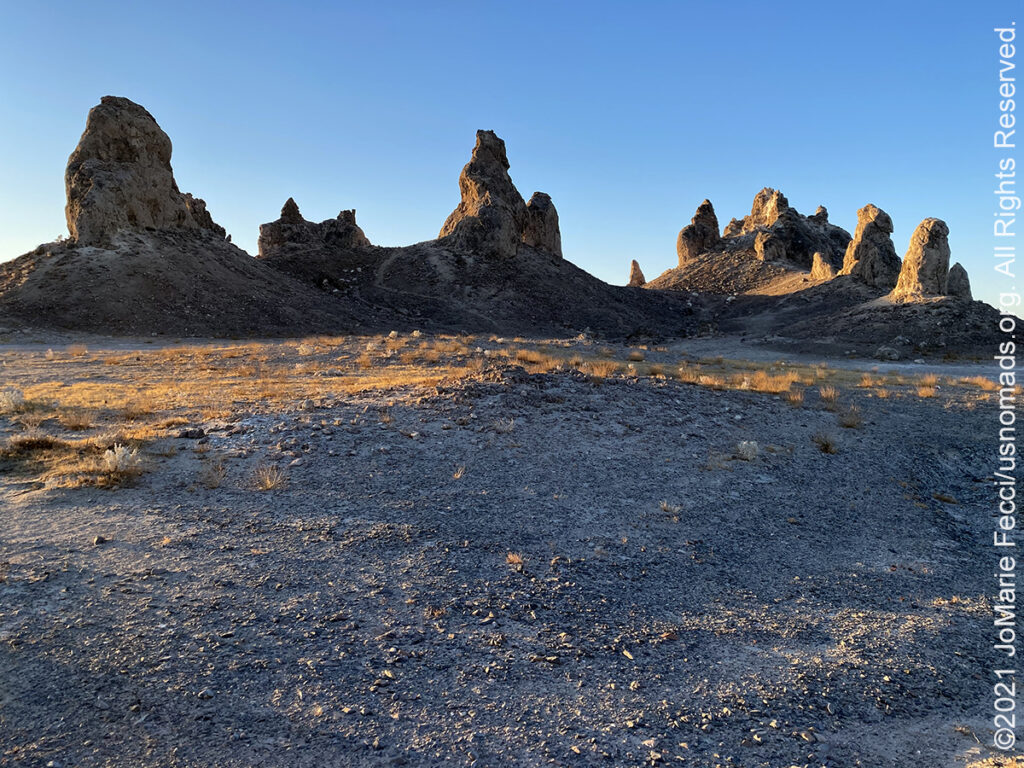
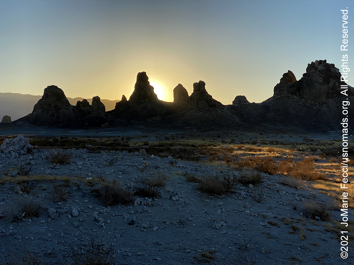
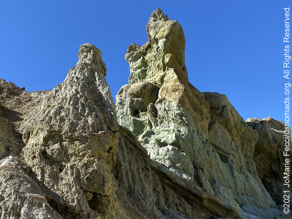
The Trona Pinnacles are a unique geological feature in the California Desert Conservation Area. The unusual landscape consists of more than 500 tufa spires, some as high as 140 feet, rising from the bed of the Searles Dry Lake basin. The pinnacles vary in size and shape from short and squat to tall and thin, and are composed primarily of calcium carbonate (tufa). They sit isolated and slowly crumbling away near the south end of the valley, surrounded by many square miles of flat, dried mud and with stark mountain ranges at either side. The unique formations have their origins in the Pleistocene, when massive runoff spilled from the Sierra Nevada into a chain of inland seas. The system of interconnected lakes stretched from Mono Lake to Death Valley and included Searles Lake. Deep beneath Searles Lake, calcium-rich groundwater and alkaline lake water combined to grow tufa formations. Similar formations can be found today at Mono Lake to the north. These tufa pinnacles formed underwater 10,000 to 100,000 years ago. The pinnacles did not all form at the same time. They are divided by age and elevation into three groups. The groups are dubbed the northern, middle, and southern groups because they formed during the three ice ages. The northern group is the youngest at 11,000 to 25,000 years old. These are the best examples of what are known as tufa towers. The northern group also include shapes called tombstones, ridges, and cones. The small middle group claims only 100 spires, but boasts the tallest “tower”, rising 140 ft . The southern group includes 200 tufa formations aged 32,000 to 100,000 years old. People have historically given names to the strange forms. These ancient spires were once dubbed “Cathedral City”. Geologically, the pinnacles are classified into four general shapes. Towers are taller than they are wide and rise 30–40 ft. Tombstones are stubby and squat and rise 20–30 feet. Ridges are massive toothy tufa ruins. Trona has three ridges, one in the northern tufa cluster and two in the middle group. Cones are less than 10 ft tall. The Trona Pinnacles have been featured in many commercials, films, and still-photo shoots. They were designated a National Natural Landmark by the U.S. Department of the Interior in 1968 to preserve one of North America’s most outstanding examples of tufa tower formation. The Trona Pinnacles are located approximately 20.0 miles east of Ridgecrest. Access to the site is from a BLM dirt road (RM143) that leaves SR 178, about 7.7 miles east of the intersection of SR 178 and the Trona-Red Mountain Road. The 5.0-mile long dirt road from SR 178 to the Pinnacles is usually accessible to 2-wheel drive vehicles, however, the road may be closed during the winter months after a heavy rain. Dispersed camping is allowed on for a period not to exceed 14 days within a 28 consecutive day period.
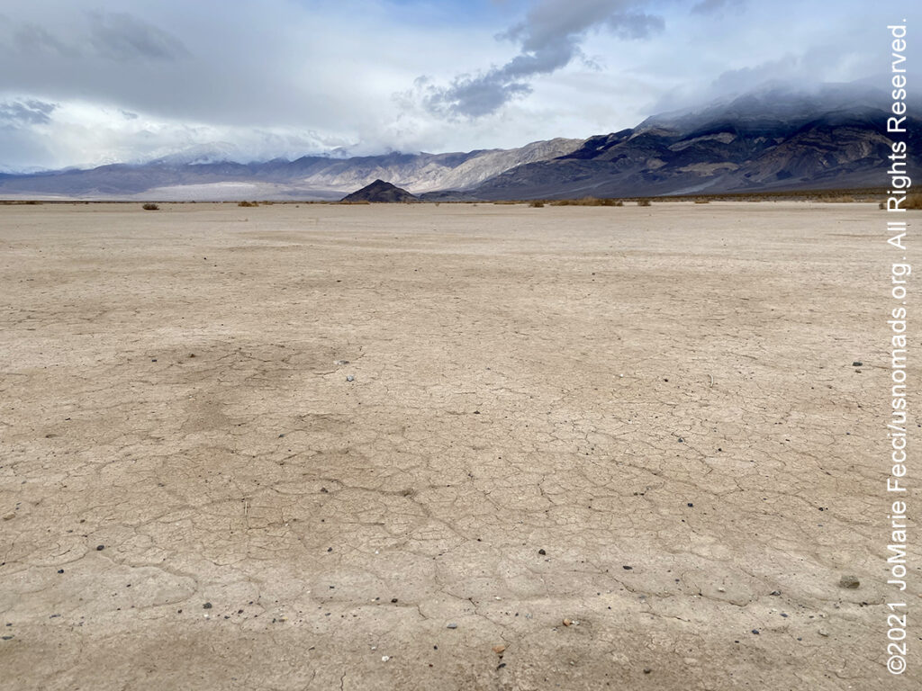
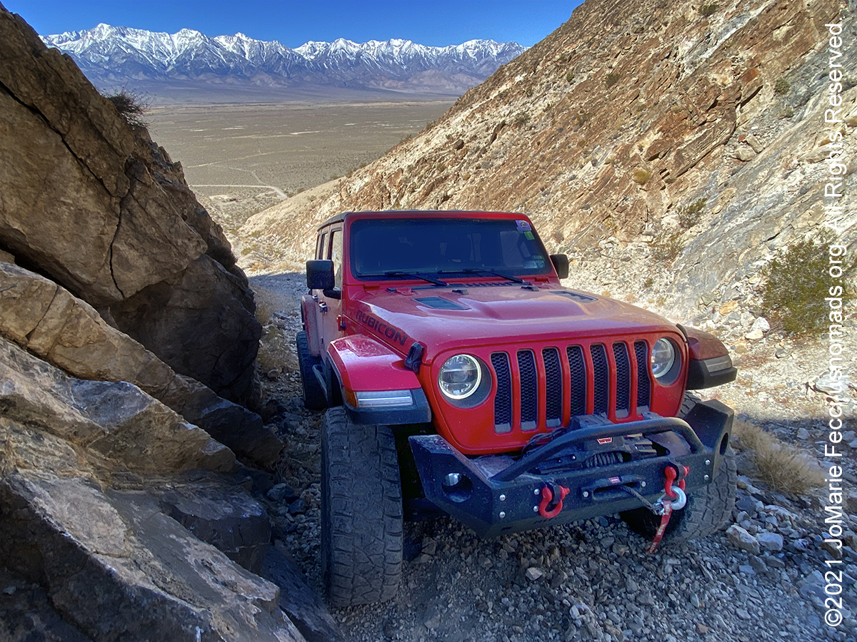
The Panamint Valley is a long basin located west of the Panamint Mountains, an immense range of twisted, sharply creased sedimentary rock in the northeastern reach of the Mojave Desert. The valley lies in a north–south direction, and stretches from the Panamint Dunes in the north to the Naval Air Weapons Station China Lake in San Bernardino County in the south. The northern end of the valley is actually part of Death Valley National Park. Panamint Valley is approximately 65 miles in length, and is more than 10 miles wide in the Hall Canyon area. The airspace over the valley is part of the U.S. military’s vast R-2508 Special Use Airspace Complex, primarily used by military aircraft from Nellis AFB, Edwards AFB, NAWS China Lake, and NAS Lemoore for high and low altitude mission training. The Valley is part of the traditional homelands of the Newe (Western Shoshone) and Northern Paiute Tribes. Local tribes, such as the Timbisha Shoshone Tribe of Death Valley, continue to value the area and engage in traditional uses there. The entire Valley is well preserved from development and may constitute a nationally significant cultural landscape.
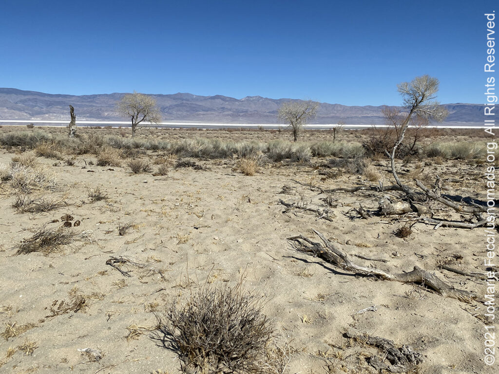
Owens Valley is an arid valley located to the east of the Sierra Nevada and north of the Mojave Desert. It sits on the western edge of the Great Basin. Because the mountain peaks on the west side, which include Mount Whitney, reach above 14,000 feet in elevation, while the floor of the Owens Valley is about 4,000 feet, geologists consider the Owens Valley to be the deepest valley in the United States. The rain shadow cast by the Sierra Nevada means the valley receives less than 6 inches of precipitation annually and the semi-arid and spectacular landscape is characterized as high desert. The bed of Owens Lake, a predominantly dry alkali flat, sits on the southern end of the valley. The region was inhabited by seminomadic Native Americans thousands of years ago. Evidence of their early hunter-gather culture has been documented in the traces of their sophisticated irrigation systems that were built to sustain small, efficient croplands. In historic times, the valley was inhabited by the Timbisha in the extreme south end around Owens Lake and by the Mono tribe (also called Owens Valley Paiute) in the central and northern portions of the valley.
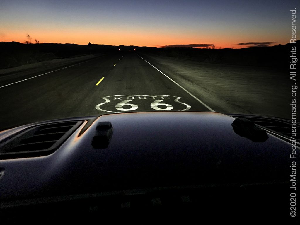
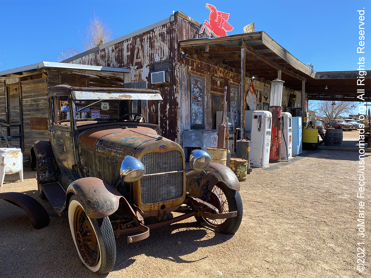
U.S. Route 66, established in 1926 was one of the original highways in the U.S. Highway System. Popularly known as the Mother Road, U.S. Highway 66 holds a special place in American consciousness and evokes images of simpler times, mom and pop businesses, and the icons of a mobile nation on the road. While Route 66 no longer officially exists, the majority of it remains to be driven and enjoyed. The highway, which became one of the most famous roads in the United States, originally ran from Chicago, Illinois, through Missouri, Kansas, Oklahoma, Texas, New Mexico, and Arizona before terminating in Santa Monica in Los Angeles County, California, covering a total of 2,448 miles. It was recognized in popular culture by both the hit song “(Get Your Kicks on) Route 66” and the Route 66 television series, which aired on CBS from 1960 to 1964. US 66 served as a primary route for those who migrated west, especially during the Dust Bowl of the 1930s, as poignantly described in John Steinbeck’s classic American novel, The Grapes of Wrath (1939). The road supported the economies of the communities through which it passed. People doing business along the route became prosperous due to the growing popularity of the highway, and those same people later fought to keep the highway alive in the face of the growing threat of being bypassed by the new Interstate Highway System. US 66 was officially removed from the United States Highway System in 1985. Portions of the old road have been designated a National Scenic Byway under the name “Historic Route 66.”
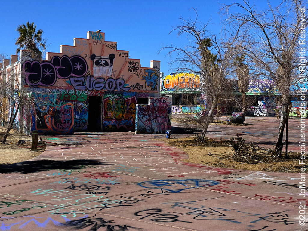
This Abandoned Waterpark, located off I-15 in the Mojave Desert near Newberry Springs, CA, has been transformed with spray paint into an unofficial guerrilla art park. The waterpark had operated under numerous names, including Lake Dolores, Rock–A–Hoola Waterpark, and Discovery Waterpark. The original Lake Dolores Waterpark (“Fun spot of the desert”) opened in 1962, and was abandoned in 2004. The park was designed by local businessman Bob Byers and Lake Dolores was named after Byers’ wife. The park saw its peak attendance between the early 1970s and the mid-1980s, when it closed for the first time after a downturn in popularity. It became Rock-a-Hoola in the 1990s, and only lasted a few years before filing for bankruptcy in 2000. It opened as Discovery in 2002, but closed for good in 2004 and the rides were dismantled. In the years that followed, it became something of a symbol of post-apocalyptic culture in the desert — a rummage yard for metal scraps, a canvas for graffiti artists, and an obstacle course for thrill-seeking skateboarders.
Rainbow Basin Natural Area is a geological formation in the Calico Peaks range, located approximately 8 miles north of Barstow in the Mojave Desert. A mixture of public and private land, it is managed by the Bureau of Land Management and is accessible to the public via Irwin Road from Barstow to an unpaved scenic loop road through the colorful basin. There is no camping within Rainbow Basin itself, but the Owl Canyon Campground is nearby. The basin is notable for the fantastic and beautiful shapes of its rock formations. The thick sedimentary layers can be divided into three distinct formations. The lowest is called the Jackhammer Formation, and it is composed of layers of sandstone, siltstone, limestone, and conglomerate, all probably dating to the early Miocene Epoch. Above this is the Pickhandle Formation. The sediments making up this formation are mostly of volcanic origin – tuff, rhyolite and andesite, indicating that they were laid down during a period of active volcanism. The highest of the three formations is the Barstow Formation, which is made up of layers of conglomerate, limestone, sandstone, and shale. Finally, on top of everything else, is a relatively thin layer of fanglomerate (alluvial fan deposits) laid down during the late Pleistocene period. Differential erosion of rocks of different hardness finished the job of sculpting the formations into the fantastic shapes that can be seen in Rainbow Basin today.
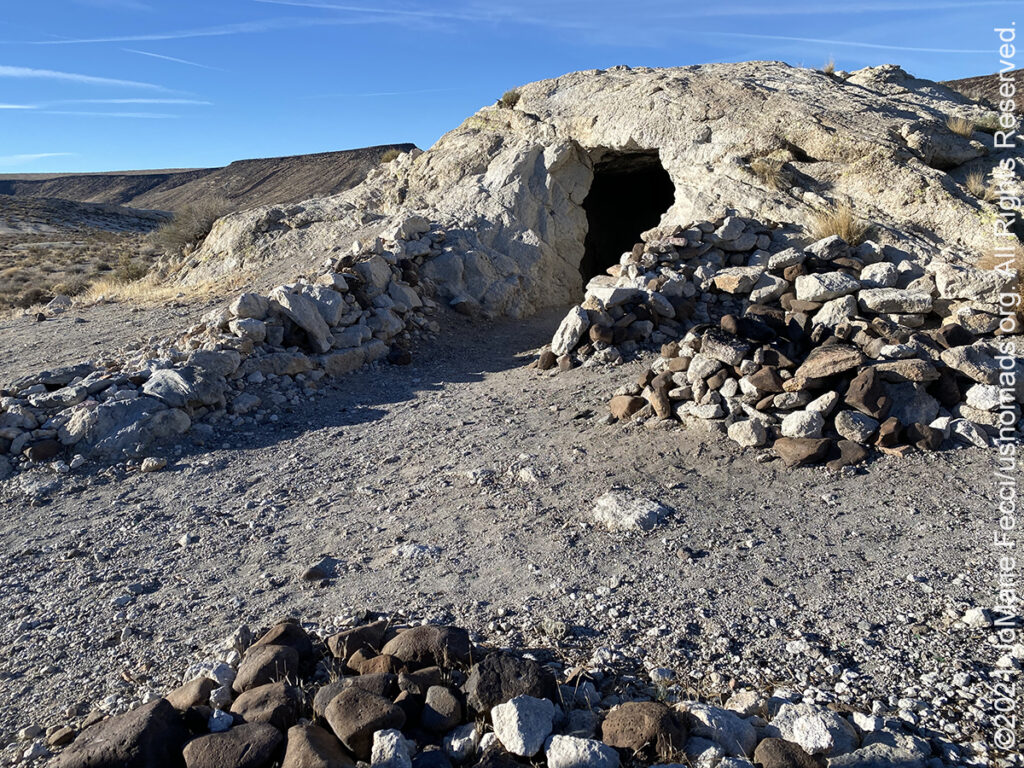
Scout’s Cove was a mining site for opals in the early 20th century. It is near the Black Mountain Wilderness area and Opal Mountain. The Black Mountains cover a very remote portion of the Mojave Desert northwest of Barstow. Beyond the designated wilderness area, is a large section of BLM-managed land. Scout’s Cove can be reached via the Black Canyon road. This road was once part of the stagecoach route that ran between the Cajon Pass and Panamint City near Death Valley during the 1870s, when there was a silver rush in the Panamint Mountains. Scout’s Cove was originally the site of the Black Mountain Opal Company mining operation. Since the 1940s, this area has been popular with rock hounds and gem collectors. Green and orange opal used to be plentiful here, as was thomsonite, agate and jasper. Now however, the area is so picked over it would be hard to find anything valuable. Scout’s Cove consists of a small valley with mounds of white rock. It is in the white rock that the opal and other gems are found. There are many prospecting holes in the mounds, and one of the tufa domes has a small dugout that miners carved out to make a nice shelter which can be used by campers on a first-come, first-served, basis.
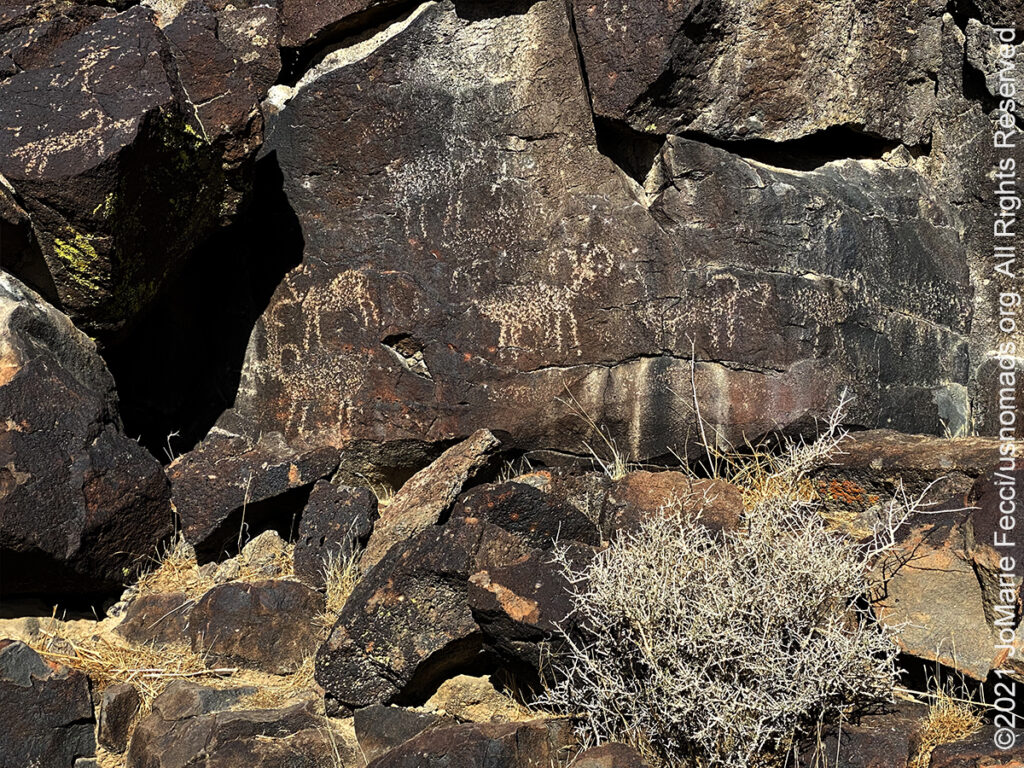
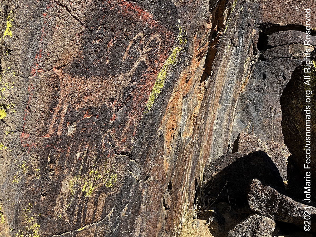
Inscription Canyon is part of the Black Mountain Rock Art District, an archaeological district located in the Mojave Desert northwest of Barstow. The district includes a large collection of Native American rock art, including over 12,000 petroglyphs. The grouping found in Inscription Canyon is the largest, with over 1,000 of the designs including humanoid figures, shields, masks, baskets, deer, bighorn sheep, and other plants and animals. There are also petroglyphs that represent patterns such as circles, lines, and zigzags. Short and narrow, the canyon is basically two walls of volcanic rock standing side by side. The rock art continues on both sides along the length of the canyon in a vast array of styles suggesting that the art was created by people of several different cultures over a great many years. Experts estimate that the oldest etchings were created by Archaic people perhaps as early as 12,000 years ago.
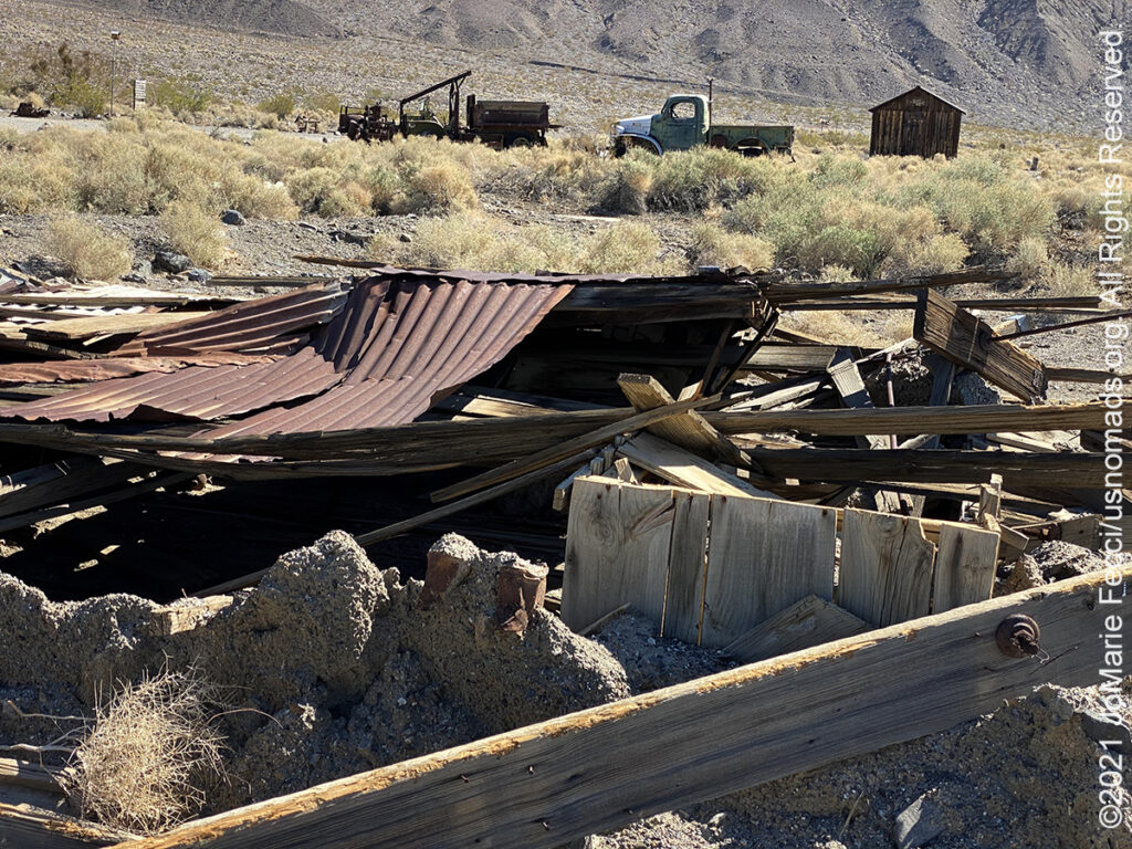
The ghosttown of Ballarat, sitting at the base of the Panamint Mountain Range, is located 3.6 miles from the pavement of the north-south Trona-Wildrose Road, north of Trona. The town began in 1897 as a supply point for the nearby mines, and become dependent on the Radcliffe Mine in Pleasant Canyon which produced 15,000 tons of gold ore from 1898 to 1903. The settlement, built of adobe bricks, soon sported seven saloons, three hotels, a Wells Fargo Station, post office, school, a jail, and a morgue, but not a single church. The town began its demise when the Radcliff Mine suspended operations in 1903. Soon afterward, other mines began to fold as the gold played out. In 1917, the post office closed and the only remaining residents were a few die-hard prospectors, including Shorty Harris, who lived there off and on, until his death in 1934. Today, the lonely ghosttown still has one or two full-time residents and a little store/museum. But mostly it is just crumbling walls and foundations. Abandoned trailers and trucks dot the landscape, including a 1942 Dodge power wagon that belonged to Charles Manson family-member and convicted murderer Tex Watson.
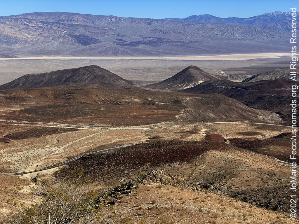
Father Crowley Point, located near the western park boundary, was a favorite stopping place for travelers, long before the creation of Death Valley National Park. One of those travelers was Father John J. Crowley, a catholic priest responsible for ministering to the people of Inyo County Parish in the 1930s.The Desert Padre, as he was known, would often stop here to admire the views on his way to or from visiting parishioners in Death Valley, and his home in Lone Pine, CA. The overview at the vista point named for the padre offers a stunning view into Rainbow Canyon, a colorfully striped canyon created by ancient volcanic activity. A short ¼ mile walk or drive on an unpaved road leads to an overlook down across the whole Panamint Valley. In recent years, Rainbow Canyon has been nicknamed “Star Wars Canyon” by visitors who came to observe the military test flights which occur in the vicinity. Star Wars Canyon is part of the R-2508 Complex, which has been used by the military since the 1930s. The test flights were temporarily suspended in 2019 after a fatal accident involving the crash of a F/A-18 Super Hornet.
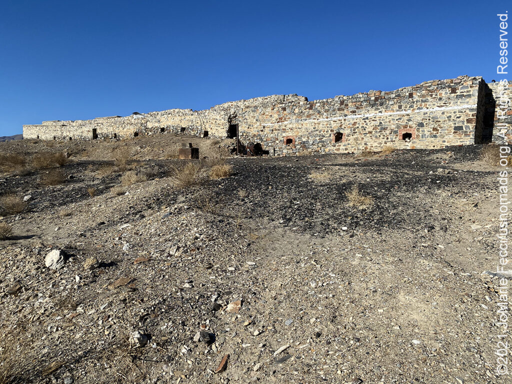
Cerro Gordo, which means literally “Fat Hill” in Spanish, is an abandoned silver mining town tucked between the tallest mountain in the continental United States — Mount Whitney — and the lowest point in North America, Death Valley. During its heyday in the mid-late 1800s, it’s believed to have produced half a billion dollars worth of silver, adjusted for inflation. Mining operations spanned 1866 to 1957, producing high grade silver, lead, and zinc ore. Discovery of the silver ore is credited to Pablo Flores, who began mining and smelting operations near the summit of Buena Vista Peak in 1865. In April, 1866, the mine was included in the Lone Pine Mining District organized in April, 1866. By 1867, tales of the silver at Cerro Gordo had spread, bringing in flocks of new prospectors. Some ore was smelted on site, but larger capacity smelters were eventually constructed along the shore of nearby Owens Lake. These smelting operations were the beginnings of the towns of Swansea and Keeler. Most of the metal ingots produced here were transported to Los Angeles by mule teams, but transportation difficulties hindered the success of the mines. In 1875, Cerro Gordo suffered a series of setbacks, forcing the shutdown of its furnaces. These problems resulted from a scarcity of ore in the mine and the temporary drying up of its water supply. A more lethal blow was dealt by falling lead and silver prices, effectively ending this era of activity at Cerro Gordo. A second mining boom focused on producing zinc in the 1910s, but by 1938 production had ended. Today the townsite is a privately-owned ghost town, with tours available by reservation.
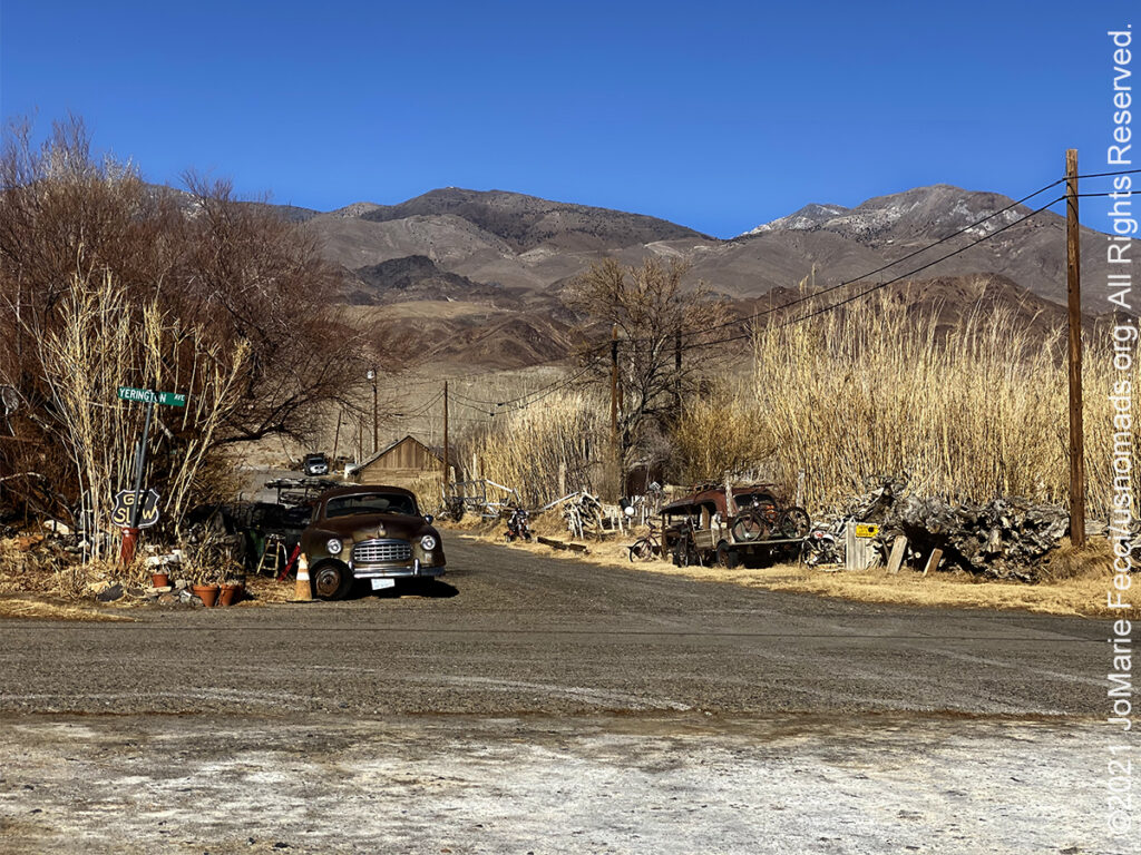
The town of Lone Pine is located in the Owens Valley, near the Alabama Hills and Mount Whitney, between the eastern peaks of the Sierra Nevada to the west and the Inyo Mountains to the east. From possible choices of urban, rural, and frontier, the Census Bureau identifies this area as “frontier”. The town is named after a solitary pine tree that once existed at the mouth of Lone Pine Canyon. On March 26, 1872, the very large Lone Pine earthquake destroyed most of the town and killed 27 of its 250 to 300 residents. At the time, the town consisted of 80 buildings made of mud and adobe; only 20 structures were left standing. During the 1870s, Lone Pine was an important supply town for several nearby mining communities, including Kearsarge, Cerro Gordo, Keeler, Swansea, and Darwin. In 1920, the history of Lone Pine was dramatically altered when a movie production company came to the Alabama Hills to make the silent film The Round-Up. Other companies soon discovered the scenic location, and in the coming decades, over 400 films, 100 television episodes, and countless commercials have used Lone Pine and the Alabama Hills as a film location. Today much of the local economy is based on tourism, as the town is between several major tourist destinations, such as Mount Whitney, Sequoia National Park, Kings Canyon National Park, Mammoth Mountain, Death Valley National Park, and Yosemite National Park.
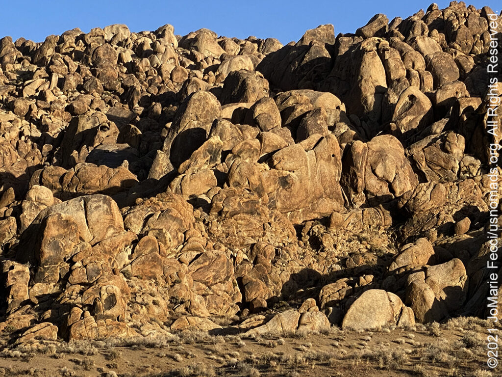
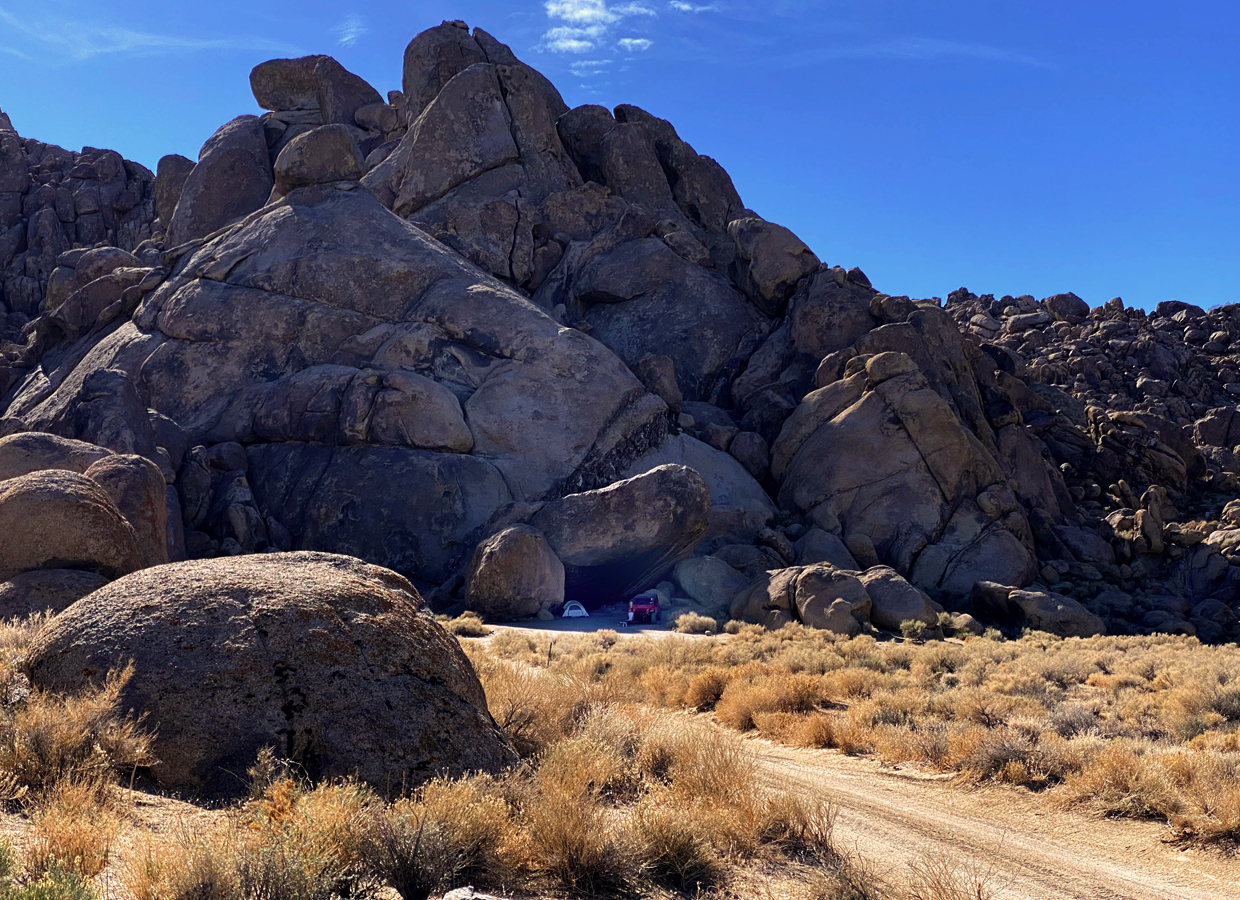
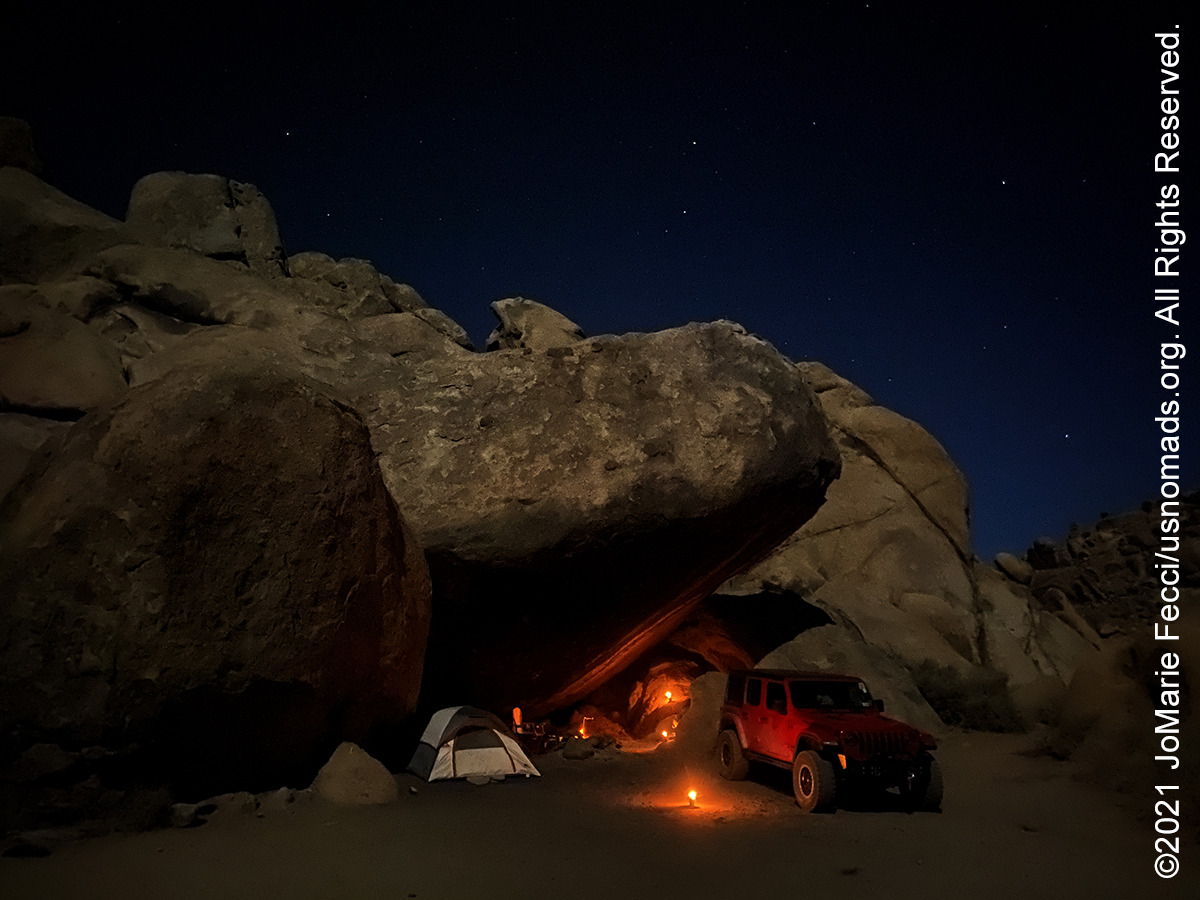
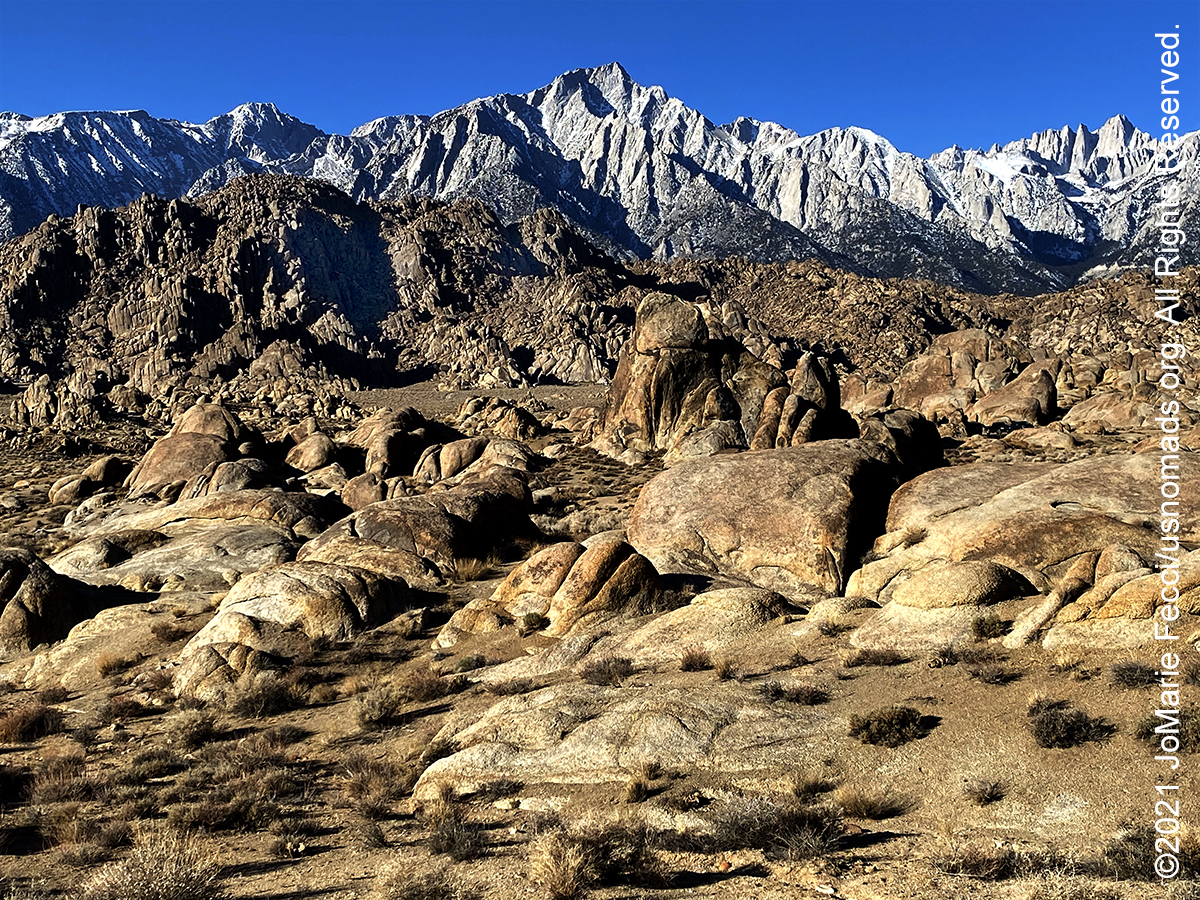
The Alabama Hills are a formation of rounded rocks and eroded hills set between the jagged peaks of the Sierra Nevada and the geologically complex Inyo Mountains. Both geologic features were shaped by the same uplifting occurring 100 million years ago. The hills are located west of Lone Pine and are managed by the Bureau of Land Management. The Alabama Hills were named for the CSS Alabama, a Confederate warship deployed during the American Civil War. When news of the ship’s exploits reached prospectors in California sympathetic to the Confederates, they named many mining claims after the ship, and the name came to be applied to the entire range. The Alabama Hills are a golden-brown wonderland of rounded hills and twisted rock formations lying between Lone Pine and the Sierra. The Alabamas, once incorrectly touted as “the earth’s oldest hills,” are now known to be the same age as the Sierra, both being formed a “few million years ago” by faulting. Identical in composition, their difference in appearance comes from different weathering processes. Up high, the freezing, expanding and thawing of rainwater and melting snow has caused the more chiseled splintering of the granite. Down in the warmer valley, the Alabamas took shape when “the climate was more moist and the rock was covered with soil,” according to a recent geologist’s report printed in “California’s Eastern Sierra” by Sue Irwin. As the climate became drier, erosion slowly stripped away the soil mantle, exposing and shaping the piles of boulders we see today. Water and wind continue the shaping process. The beige and blacks in the mottled coloring are the result of being stained for millions of years by the oxidation of the iron minerals in the rock. The Alabama Hills became well known as a location for filming starting in the 1920s, and today there is a scenic drive along the Movie Flats trail which includes a number of the iconic film locations. The drive is on easy dirt and sand roads with a few tight rock alleyways, moderately steep sand hills, and a few rocks to drive over. The Alabama Hills are an open-desert primitive and dispersed camping area with no amenities, no water, no trash, no pavement, and no facilities whatsoever. A California Campfire Permit is required for campfires, stoves, and lanterns.
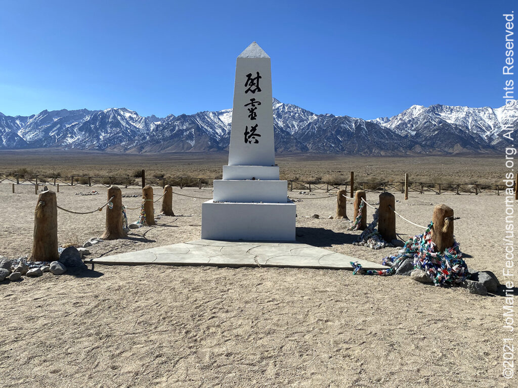
Manzanar is the site of one of ten American concentration camps, where more than 120,000 Japanese Americans were incarcerated during World War II from March 1942 to November 1945. It is located at the foot of the Sierra Nevada mountains in California’s Owens Valley, between the towns of Lone Pine to the south and Independence to the north. Manzanar means “apple orchard” in Spanish. The Manzanar National Historic Site, which preserves and interprets the legacy of Japanese American incarceration in the United States, was identified by the United States National Park Service as the best-preserved of the ten former camp sites. Since the last of those incarcerated left in 1945, former detainees and others have worked to protect Manzanar and to establish it as a National Historic Site to ensure that the history of the site, along with the stories of those who were incarcerated there, is recorded for current and future generations. The primary focus is the Japanese American incarceration era, as specified in the legislation that created the Manzanar National Historic Site. The site features a visitor center with a gift shop, housed in the historically restored Manzanar High School Auditorium with a reconstructed stage proscenium. The auditorium and the two sentry posts at the entrance are the only original structures from the time the camp was operating during World War II. Permanent exhibits and an “interpretive center” help visitors gain an understanding of some of the internees’ experiences. The Manzanar cemetery, where some of the internees who died at the camp were buried, also contains the memorial obelisk, which was built by masons in the camp in August 1943. All of the remains have been removed to other locations.
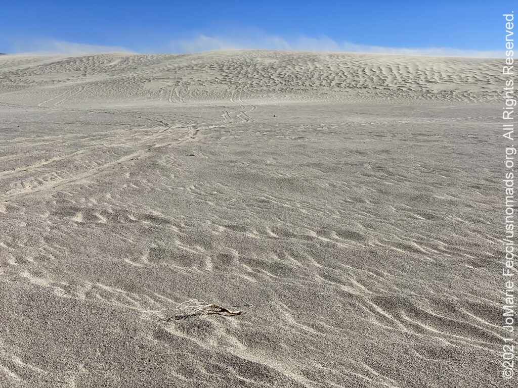
The Olancha Dunes OHV area, located at the south end of the Owens Valley just 2 miles east of Olancha along Highway 395, offers a diverse landscape for off-highway vehicle recreation. It is characterized by wide, rolling dunes framed between the towering Sierra Nevada and the Coso Range. The riding area is about 1,000 acres of short, gentle sloped dunes that peak at a height of 75 ft. The somewhat unimposing scale of these dunes often leads off-roaders to bypass the area, but it can be a great place to experience the dunes in a more wilderness setting. Most area visitors ride motorcycles or ATV/UTVs or four-wheel drive vehicles. The dirt entrance road to the dunes is signed. However, after about 100 yards the sand turns soft. The entire OHV area and surrounding public lands are open to primitive camping. Within the dune area, there are a number of excellent primitive camping sites and OHV staging/off-loading areas.
Keeler, originally known as Hawley, was established on the shore of Owens lake in the early 1870’s as a competing freight terminal for steamship travel over Owens Lake. The original terminal was six miles north at the town of Swansea. The town was home to miners most of whom lived in tents, caves, rock wall wind breakers and a few in cabins. In 1883 the Carson and Colorado Railroad was built from Belleville, Nevada, across the White Mountains to Benton and down into the Owens Valley where the rail line ended in Keeler. With the coming of the railroad, large marble quarries were opened near Keeler, producing a material which tests proved to be stronger in crushing resistance than any other known. The material was used for finishing the Mils Building in San Francisco and the floor at the Los Angeles Airport. Ultimately, the mineral industries could not sustain Keeler and in 1960 the railroad terminal closed. In 1961 the tracks were removed and Keeler’s role as a freighting center came to an end. Today Keeler is a town of a few dozen people and no operating businesses.