(Part 10)

100 Days Journey: Part 10 – Arizona to Utah
Saying goodbye to Arizona and heading north to start my return to the northeast with a pause for some exploration in southern Utah. I worked out a route that gives me a chance to do some scouting around the otherworldly landscapes of Grande-Escalante National Monument, Capitol Reef National Park and the San Rafael Swell. (Click through the images below for each day’s notes)…
Note this map provides an overview of the tenth segment of the journey–from Phoenix area to Utah, then through the Grande-Escalante National Monument, Capitol Reef and the San Rafael desert back to the highway, and across Utah into Colorado. The route on this map shows the overall direction of travel and key “stops” but does not include any detailed GPX tracks for backcountry trails, etc…
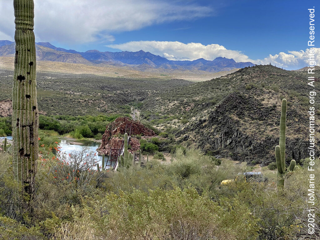
The Tonto National Forest, encompassing 2,873,200 acres, is the largest of the six national forests in Arizona and is the fifth largest national forest in the United States. The Tonto features some of the most rugged and inherently beautiful land in the country. Sonoran Desert cacti and flat lands slowly give way to the highlands of the Mogollon Rim. This variety in vegetation and range in altitude — from 1,300 to 7,900 feet — offers outstanding recreational opportunities throughout the year, whether it’s lake beaches or cool pine forest. With a southern boundary near the Phoenix metropolitan area, Tonto is also the most visited “urban” forest in the United States. One of the primary purposes for establishing the Tonto National Forest in 1905 was to protect its watersheds around reservoirs. The forest produces an average of 350,000 acre-feet of water each year. Six major reservoirs on the forest have the combined capacity to store more than 2 million acre-feet of water. Management efforts are directed at protecting both water quality and watershed and riparian area conditions.
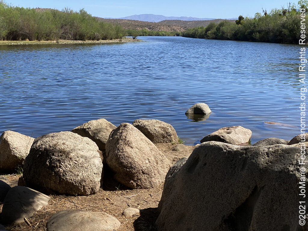
The Salt River, about 200 miles long, is the largest tributary of the Gila River. It is a recreational paradise for area residents, and is a popular spot for kayaking and tubing. The Salt River is formed by the confluence of the White River and the Black River and is fed by numerous perennial streams that start as springs and seeps along the Mogollon Rim and in the White Mountains. The river flows generally west and southwest through the Tonto National Forest until leaving the mountains near Mesa. There are four reservoirs on the Salt River: Theodore Roosevelt Lake (formed by the Theodore Roosevelt Dam), Apache Lake (formed by Horse Mesa Dam), Canyon Lake, (formed by Mormon Flat Dam) and Saguaro Lake (formed by Stewart Mountain Dam). These four reservoirs are part of the Salt River Project which provides water to the Phoenix metropolitan area for municipal, industrial, and agricultural purposes. The name Salt River comes from the fact that the river flows over large salt deposits shortly after the merging of the White and Black Rivers.
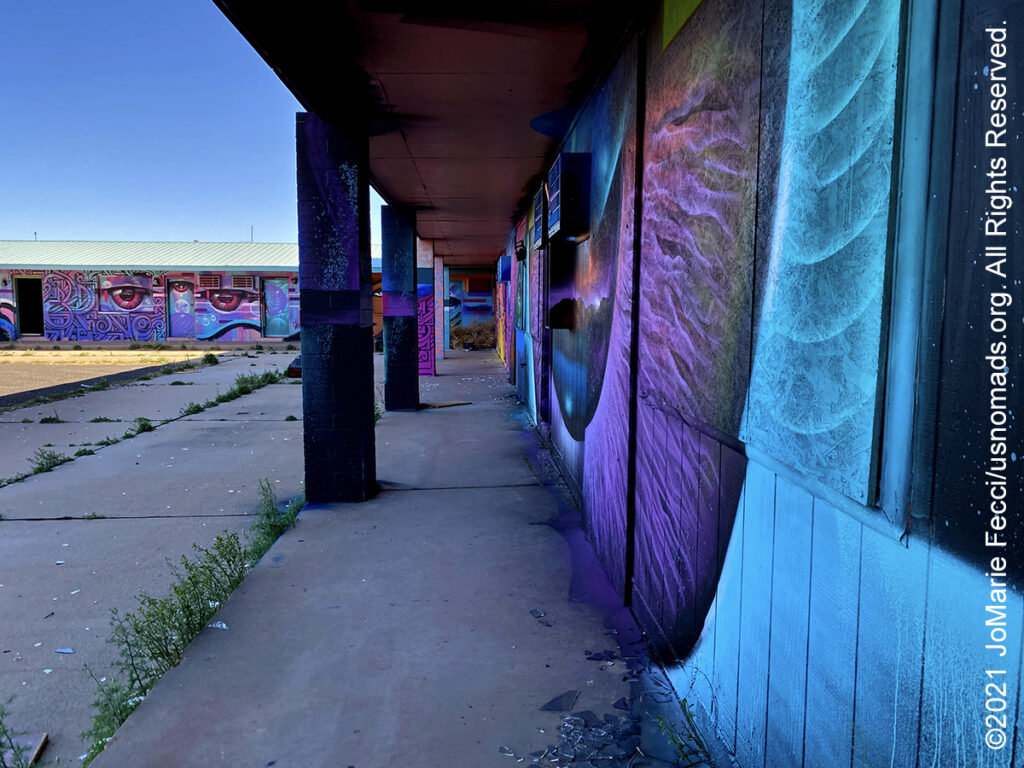
The Abandoned Anasazi Inn is an old motel on HWY 89 roughly 40 miles north of Flagstaff which has been abandoned since 2005. Today the property has became a canvas for artists from the Painted Desert Project, an organization that connects public artists with communities through mural opportunities on the Navajo Nation. The organization was founded by Navajo Nation physician and artist Chip Thomas who began wheat pasting some of his work onto abandoned structures dispersed across the landscape in 2009. In 2012 he began inviting other artists to add their own pieces and spend time on the reservation. For the Anasazi Inn motel, Thomas invited Phoenix-based Tohono O’odham artist Thomas “Breeze” Marcus to come up with a design for the two-story building. Breeze in turn invited Los Angeles-based Zuni, Rarámuri and Chicano artist Jaime “Vyal One” Reyes to work alongside him and pretty soon they had more talent on board in the form of Diné painter Jerrel Singer, who grew up in the Gray Mountain area, Apache artist Douglas Miles and Diné artist LivA’ndrea Knoki. The mural itself is open to interpretation, allowing passersby of all ages to find appreciation in the intricate ribbons of color brightening the desert landscape.
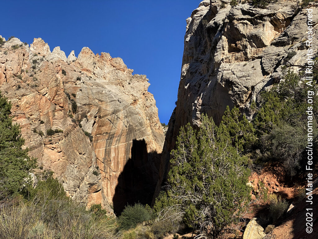
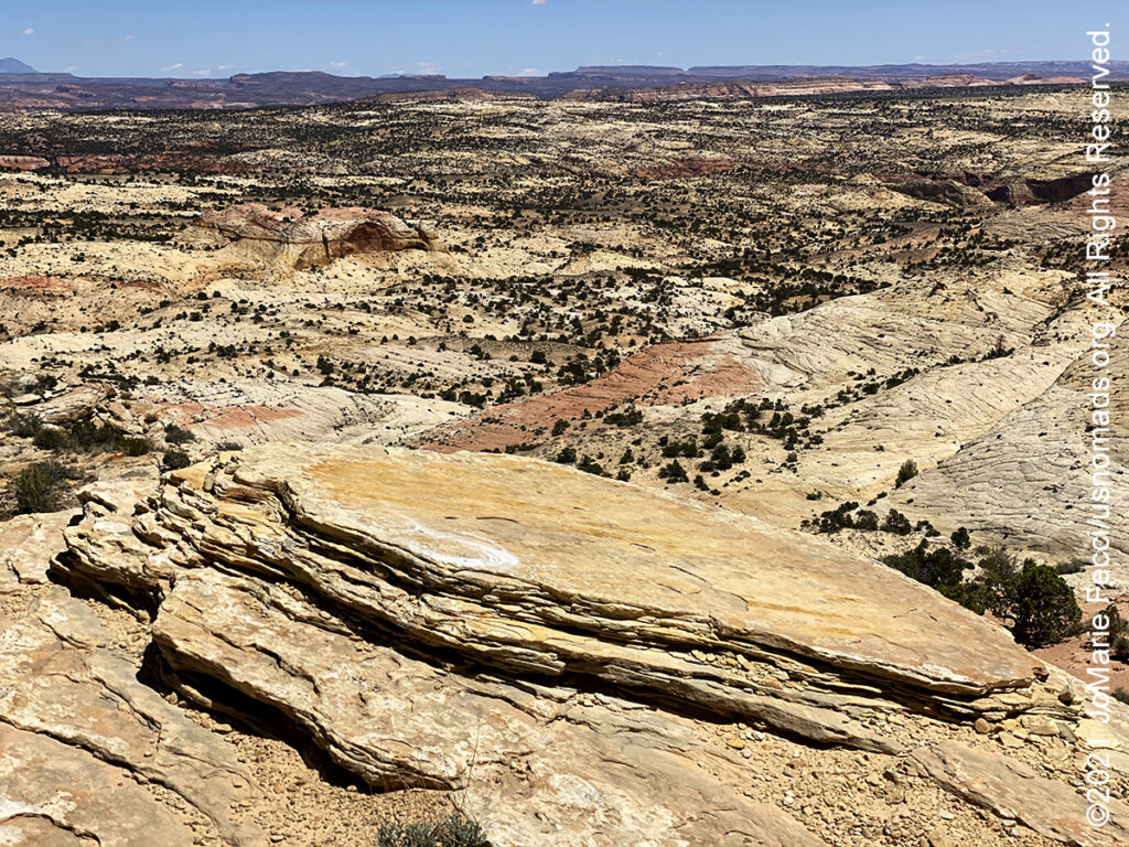
The Grand Staircase–Escalante National Monument in southern Utah is one of the most remote areas in the country–it was the last region to be mapped in the contiguous United States. The Monument is a diverse geologic treasure speckled with monoliths, slot canyons, natural bridges, and arches. President Bill Clinton set it aside as a national monument in 1996 because its untrammeled significance distinguishes it for researchers and explorers alike. A 200-million-year-old staircase that is like a museum of sedimentary erosion, it tells the story of animals, minerals and vegetables through time. The monument spans five life-zones – from low-lying desert to coniferous forest. Deep within this vast and austere landscape, the Anasazi and Fremont cultures made contact in the period AD 950-1100, leaving behind rock art panels, occupation sites, campsites and granaries. Stepping further back in time, fossil excavations have yielded more information about ecosystem change at the end of the dinosaur era than any other place in the world. It’s also a big empty playground for off-roaders, canyoneers and hikers with many jeep trails, cliffs and other photo-hungry rock forms across 1.9 million acres. The monument is divided into three main regions: the Grand Staircase, the Kaiparowits Plateau, and the Canyons of the Escalante River. The Grand Staircase is named for the series of plateaus that descend from Bryce Canyon south toward the Grand Canyon, marked by vertical drops at the Pink Cliffs, Grey Cliffs, White Cliffs, Vermillion Cliffs and Chocolate Cliffs. The Kaiparowits Plateau, at nine thousand feet, is the highest, wildest, most arid, most remote part of the monument. It’s a big gray-green scalene triangle pointing north to Escalante on Highway 12, chock full of Late Cretaceous fossils. The Canyons of the Escalante are a rugged, desolate paradise–it’s the rocky bones laid bare after the Escalante River gnawed through earth’s flesh, an exquisite corpse of narrow canyons, towering walls and stunning grottoes. Travel within the Monument can be very unforgiving, and its wild character should not be underestimated. Before beginning any of Monument adventures, make sure to plan a way in, and a way out. Know the extended weather forecast and carry extra clothing, blankets, food and water for emergencies — cell phone coverage across the Monument is sparse if at all.

Capitol Reef National Park, in south-central Utah, was established to preserve 241,904 acres of desert landscape. The park is long and narrow, approximately 60 miles long on its north–south axis and just 6 miles wide on average. Capitol Reef was first designated a national monument on August 2, 1937, by President Franklin D. Roosevelt to protect the area’s colorful canyons, ridges, buttes, and monoliths; however, it was not until 1950 that the area officially opened to the public. The park’s name sometimes causes confusion because most people think of a “reef” as being in an ocean, not an arid desert. But locally, the term “reef” refers to any rocky barrier to land travel, just as ocean reefs are barriers to sea travel. And “capitol” comes from the whitish Navajo Sandstone cliffs with dome formations that run from the Fremont River to Pleasant Creek on the Waterpocket Fold—-which seemed similar to the white domes often placed on capitol buildings. Capitol Reef encompasses the Waterpocket Fold, a warp in the earth’s crust that is 65 million years old. It is the largest exposed monocline in North America. In this fold, newer and older layers of earth folded over each other in an S-shape. This warp, probably caused by the same colliding continental plates that created the Rocky Mountains, has weathered and eroded over millennia to expose layers of rock and fossils. The park is filled with brilliantly colored sandstone cliffs, gleaming white domes, and contrasting layers of stone and earth. The fold forms a north-to-south barrier that has barely been breached by roads. The first paved road was only constructed through the area in 1962. State Route 24 cuts through the park traveling east and west between Canyonlands National Park and Bryce Canyon National Park, but few other paved roads invade the rugged landscape.
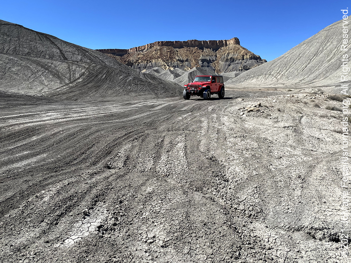
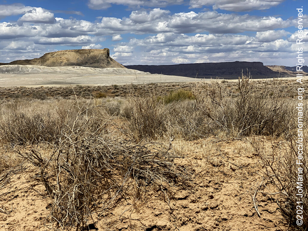
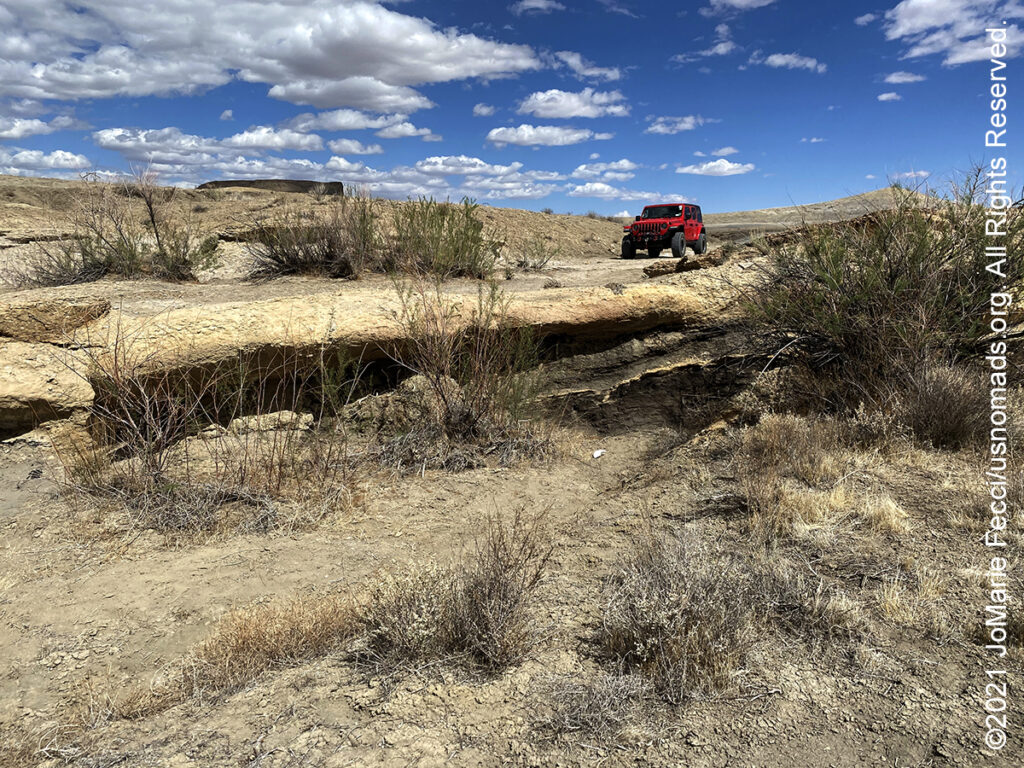
The San Rafael Swell is a large geologic feature located in south-central Utah. Measuring approximately 75 by 40 miles, the Swell, consists of a giant dome-shaped anticline of sandstone, shale, and limestone that was pushed up during the Paleocene Laramide Orogeny 60–40 million years ago. Since that time, infrequent but powerful flash floods have eroded the sedimentary rocks into numerous valleys, canyons, gorges, mesas, buttes, and badlands. It is part of the Colorado Plateau physiographic region. For years the San Rafael Swell has been considered one of the “undiscovered” natural wonders of the American West. Managed by the Bureau of Land Management, San Rafael Swell Recreation area offers visitors many of the same sights that can be seen in several of Utah’s national parks but allows these visitors to enjoy these sights in leisurely solitude. The San Rafael Swell also provides sights that cannot be found anywhere else, such as Goblin Valley and the San Rafael Reef. The area features magnificent badlands of brightly colored and wildly eroded sandstone formations, deep canyons, and giant plates of stone tilted upright through massive geologic upheaval. There are petroglyphs and historical areas throughout the Swell and endless possibilities for recreational experiences including: hiking, biking, four wheel driving, horseback, canyoneering, and river running.
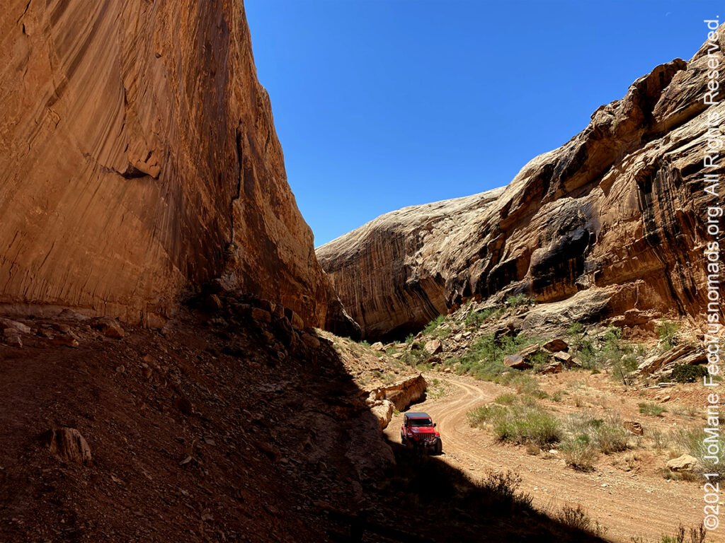
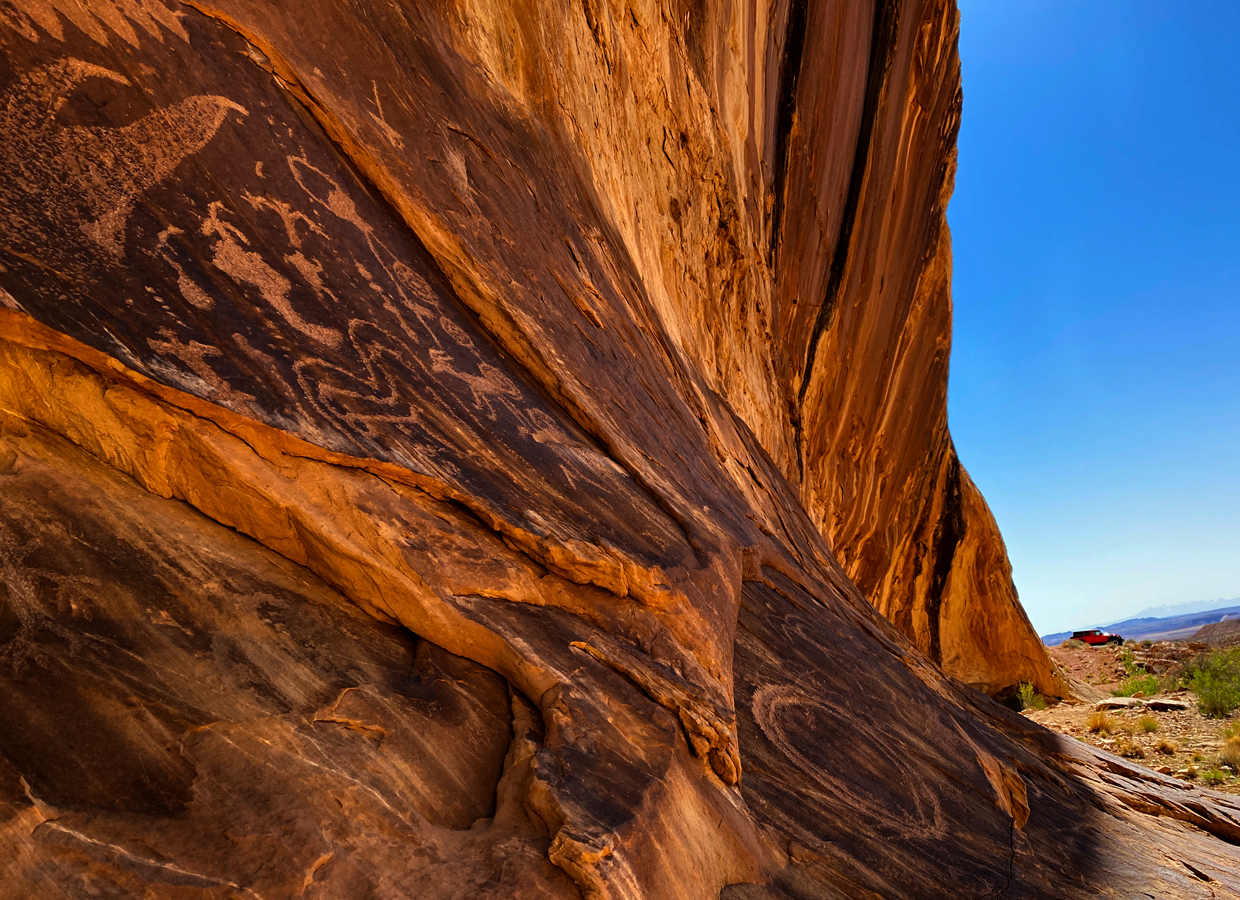
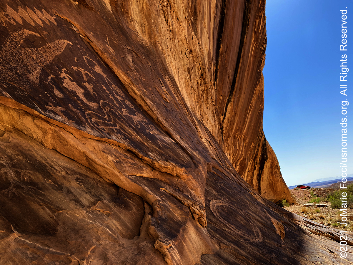
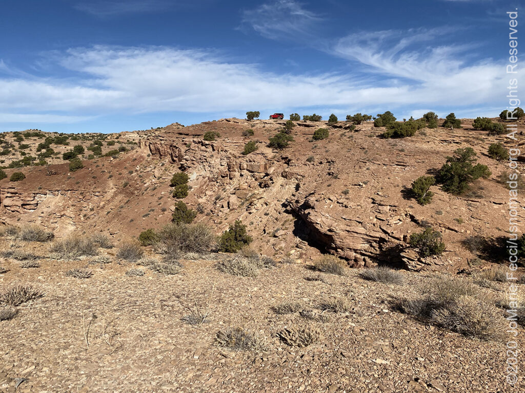
Black Dragon Wash trail combines incredible history, amazing photographs of the high canyon walls, and even a few challenges along the way. A mysterious red pictograph panel accompanied by petroglyphs is considered to be one of the best in Central Utah. The panel site contains several elongated human and animal like pictograph images attributed to the ancient Barrier Canyon culture. Stylistically different Fremont petroglyphs are located adjacent to the Barrier Canyon pictographs. In the past someone chalked the outlines of the pictograph images, a practice now know to irreparably damage fragile rock art resources. The person chalking the images combined several figures into what appears as a Dragon-like image. This “dragon” gives the canyon its name. The road to the panel is sandy in spots and requires a high clearance vehicle. Do not travel into the area unless you are familiar with desert travel and are aware of the weather conditions.
Cottonwood Canyon Road is a 47-mile unpaved route through Grand Staircase-Escalante National Monument, starting in the south along HWY 89 near milepost 18, and eventually leading past Kodachrome Basin State Park to the scenic byway on UT-12. Much of the road follows along the Coxcomb, a series of valleys formed by upturned rock layers, and there is much to explore, including slot canyons, arches, springs and endless colorful, eroded rocky scenery. Beginning at the intersection with HWY 89, Cottonwood Canyon Road crosses a desolate landscape of undulating badlands, grey to brown in color with no covering vegetation – layers of the Tropic Shale formation — before dropping down into the Paria River Valley. The Paria soon turns away northwest at the junction with Cottonwood Creek, and the road follows the creek along a very straight canyon bordered by the upturned strata of the Coxcomb – an elongated series of ridges running along the valley, created by erosion of upwardly-pointing folded rock layers. The rocks at either side of the Coxcomb have strange faded whitish-grey colors. There are several interesting hikes along the the road including the Cottonwood Wash Narrows hike, and at mile 30, there is the the turn off to Grosvenor Arch. The main road then bends westwards en route to Kodachrome Basin State Park, at which point it becomes a paved road terminating at the intersection with UT-12.
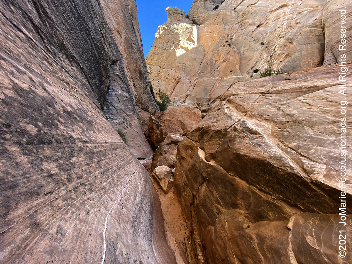
The Cottonwood Wash Narrows is a short and easily explored slot canyon. The narrows may be entered either along the bed of the side drainage or through an opening in the cliffs 100 feet south. The canyon is interesting for a few hundred yards upstream and for one mile downstream, although the upper part is best – a few places are as narrow as any other of the Paria tributary canyons, with some minor dryfalls and pools and plenty of nice rock formations. Beyond the end of this section, the wash continues northwards for many more miles through a shallow, boulder-strewn valley. Turning south at the entrance, the wash becomes quite deep and generally rather wide – for long distances sandbanks with trees and bushes line the streamway on both sides but there are also a few dark narrow passages, enclosed by high, vertical cliffs of Navajo sandstone streaked with desert varnish. After about a 20 minute walk, the canyon bends 90 degrees to the east and cuts through the ridge separating it from the road, and thereafter flows south through a much wider valley. The hike is completed by walking up the road back to the parking area, and the round trip to both parts of the narrows takes just one hour.
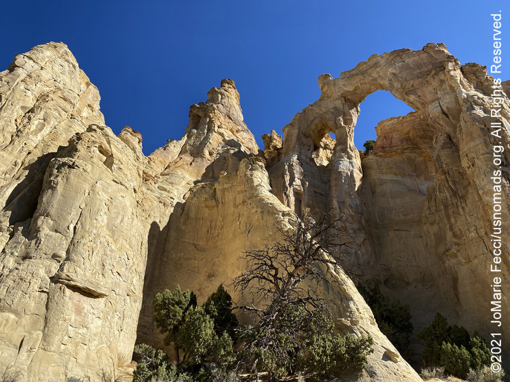
Grosvenor Arch, located in the north western corner of the Grand Staircase Escalante National Monument, is a unique sandstone double arch towering 150ft above the ground. It is perhaps the most accessible and spectacular natural feature to found along the Cottonwood Canyon Road. At the end of an isolated ridge of yellowish-white Henrieville sandstone, the double arch is one of the most photographed places in the national monument. The larger of the two arches is nearly 100ft in diameter. It is named after Gilbert Hovey Grosvenor, president of the National Geographic Society – the first full time editor of National Geographic Magazine.
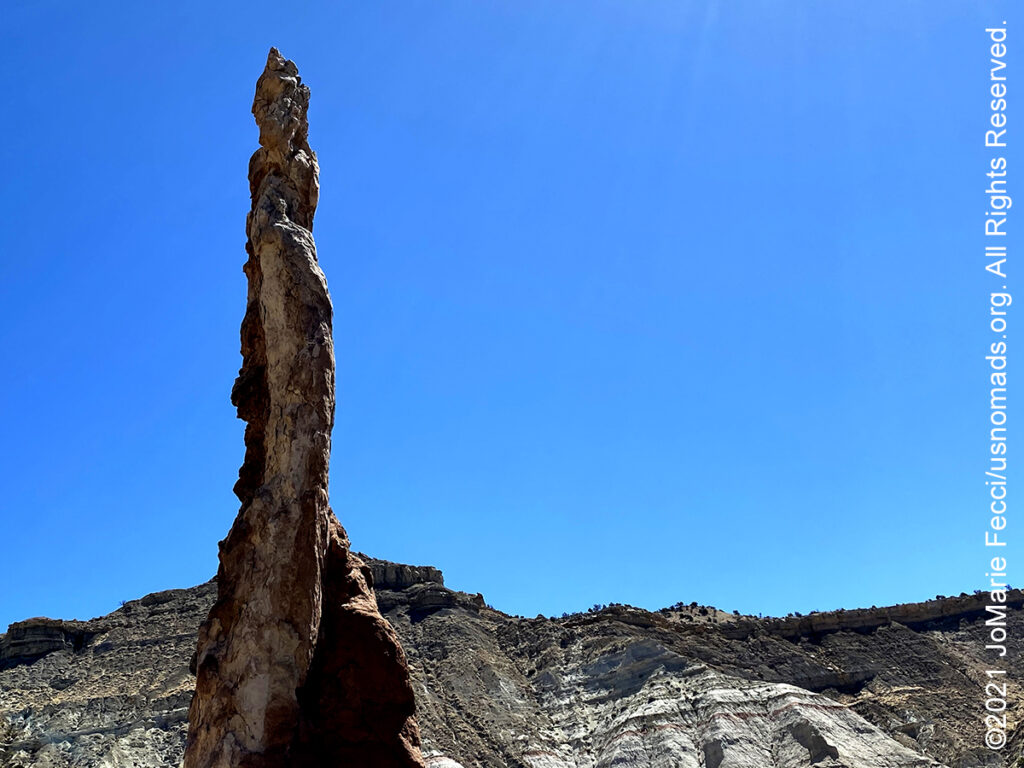
Kodachrome Basin State Park with its red-tinged rock formations and incredible blue skies, just begs to be photographed. Towering monolithic spires or chimneys jut up from the valley floor or protrude from the sandstone rocks that surround the campground and inspire an infinite array of subjects limited only by one’s imagination. This Utah state park contains 67 monolithic stone spires, called sedimentary pipes, that accentuate multihued sandstone layers revealing 180 million years of geologic time. The color and beauty found here prompted a National Geographic Society expedition to name the area Kodachrome, after the popular color film, in 1948.
UT-12, Utah’s Scenic Byway also known as “A Journey Through Time Scenic Byway,” is 123 miles of pure driving bliss. UT-12 connects U.S. 89 near Panguitch on the west with S.R. 24 near Torrey on the northeast. It is not the quickest route between these two points, but it far and away the best. The road climbs into the Dixie National Forest, and a stop at the scenic overlook near the road’s summit at about 9,000 feet puts it all into perspective. Atmosphere envelopes distant lands, the Henry Mountains, Grand Staircase–Escalante and the shimmering red rock of Capitol Reef National Park. Contrasting stands of subalpine fir and aspen decorate the immediate surroundings. While driving the byway, starting from Panguitch and heading east, you’ll enjoy going through the two red arches in Red Canyon, then lay witness to the actual “stairs” in the Grand Staircase–Escalante National Monument just past Henrieville — a different color of sandstone to the north and to the south. Along the “Hogsback” between Escalante and Boulder, hairpin turns dare you on a road that drops off drastically from the shoulders down into deep canyons below. You’ll yet again change geography as you traverse through the aspen and pine groves, and meadowlands of Boulder Mountain before finally heading back to the desert near Capitol Reef.
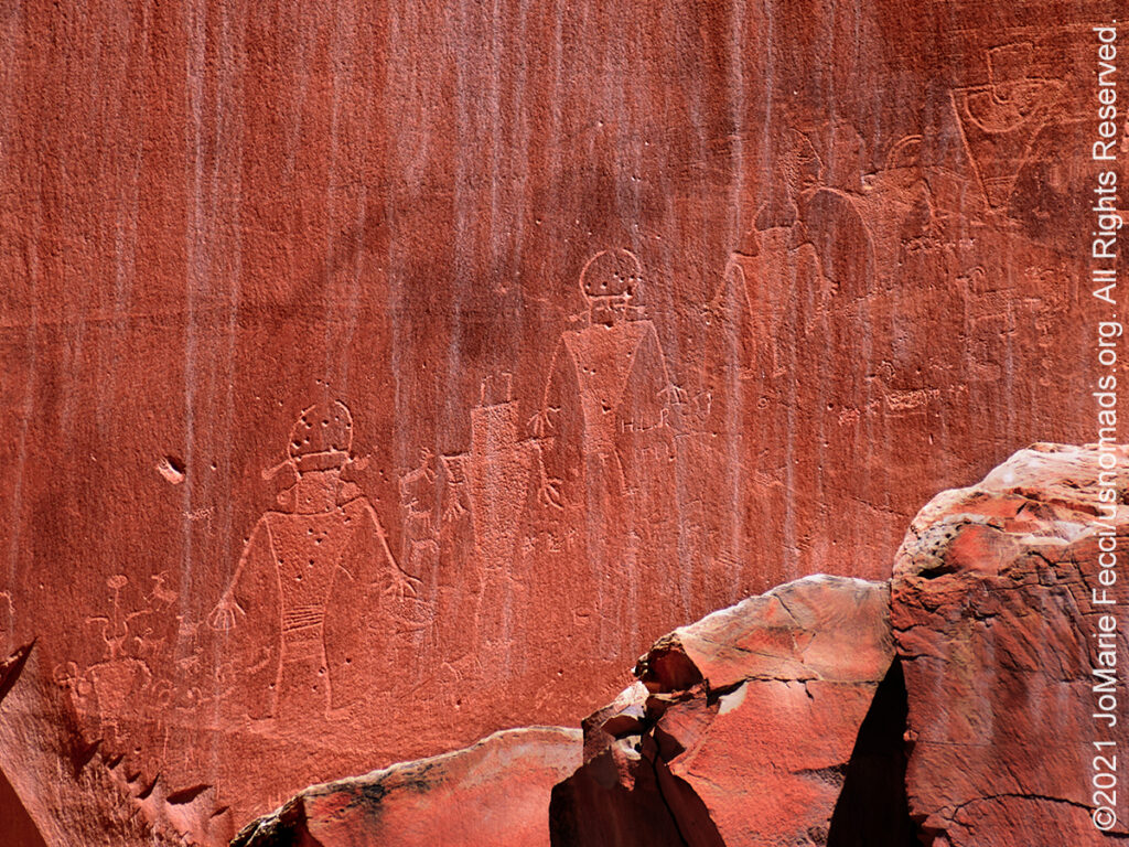
The Capitol Reef Petroglyphs are easily accessible along Utah State Route 24. The etchings were made by people from the Fremont Culture who lived in what is now Utah for about one thousand years, from 300-1300 Common Era. Archeologists named these people the Fremont Culture, for the Fremont River canyon where they were first defined as a distinct culture, and petroglyphs are one of the most visible aspects of their culture that remains. The petroglyph panels along this area of the Fremont River are accessible via short, easy walks along two boardwalks. The site is quite pleasant, shaded by cottonwood trees. The main panel, found at the end of the western boardwalk, is a well preserved panel with anthropomorphic (human-like) figures that have trapezoidal shaped bodies with arms, legs and fingers. The figures are adorned with headdresses, ear bobs, necklaces and clothing items. The panel also includes bighorn sheep, deer, a rabbit and other animals. The second boardwalk, to the east, skirts the base of the Wingate cliffs. The petroglyphs along this section of the wall are fainter and harder to see. Some of the human-like figures wear clothing with geometric patterns and have well defined hands. Other images look like necklaces, stars or animals, such as deer and sheep.
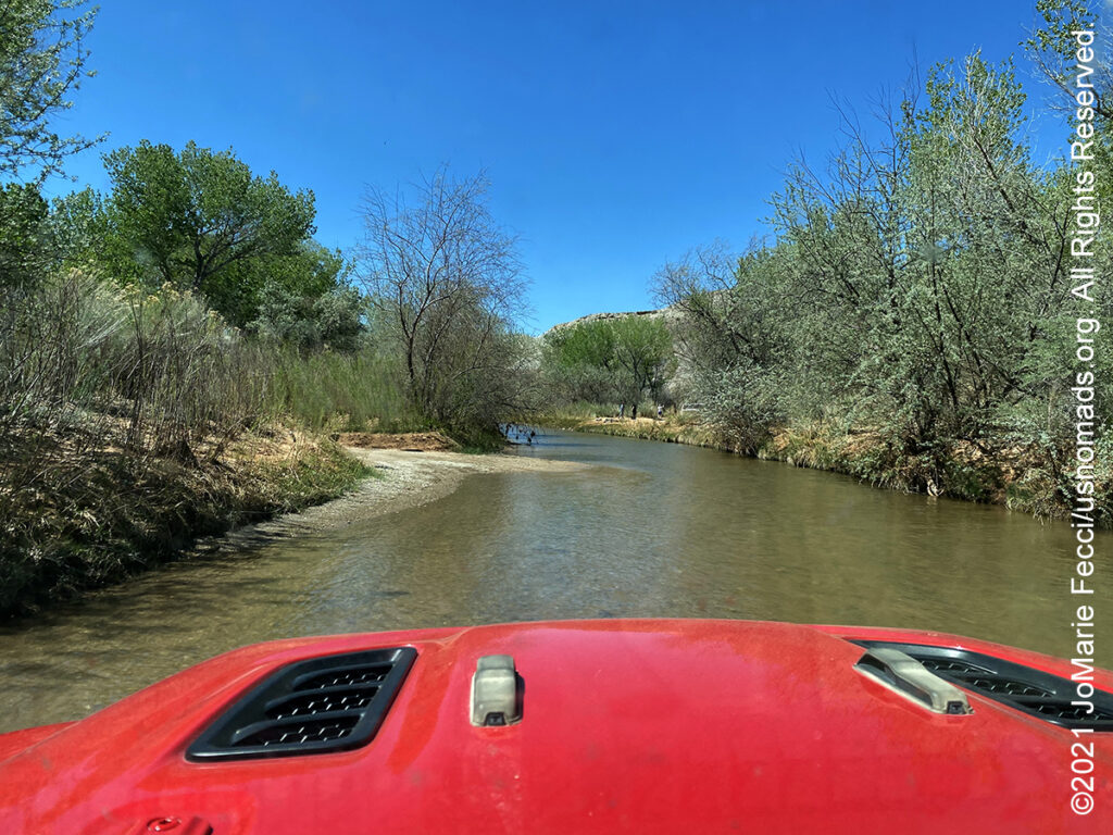
The Cathedral Valley District of Capitol Reef National Park is a remote, rugged region. The driving loop takes about 6-8 hours to complete. Most visitors to Cathedral Valley drive the 57.6 mile loop clockwise, beginning on the Hartnet Road located 11.7 miles east of the visitor center on Highway 24 and continuing on that for 27.8 miles to Hartnet Junction. Turn north onto Cathedral Road and driving 29.9 miles back to Highway 24 will complete the loop. There are many side trips and hiking opportunities along the way. The south end of the Hartnet Road near Highway 24 requires fording the Fremont River–there is no bridge over the river. Do not attempt to cross the river during floods or other periods of high water. AThe ford has a hard packed, rocky bottom and water levels are normally a foot or less deep. The access road to the River Ford crosses private land. Please honor the posted no trespassing signs along the road near the ford by not parking off-road or camping in the vicinity. Vehicles with high ground clearance, even those without four-wheel drive, can usually negotiate the roads without difficulty. However, road conditions can vary greatly depending on recent weather conditions. Foot and vehicle travel in the Cathedral Valley area is light, so be prepared for the unexpected. If you have problems, help may not arrive for hours or even days, depending on the time of year. Carry plenty of water, food, gas, adequate clothing, a shovel, and emergency supplies. No potable water is available in Cathedral Valley, although there is one primitive campground that has a pit toilet. Cell phone reception is usually poor to nonexistent.

The Bentonite Hills, located outside the park boundary on Bureau of Land Management land, appear as softly-contoured, banded hills in varying hues of brown, red, purple, gray, and green. The hills are composed of the Brushy Basin shale member of the Morrison Formation. This layer was formed during Jurassic times when mud, silt, fine sand, and volcanic ash were deposited in swamps and lakes. Bentonite clay (altered volcanic ash) absorbs water and becomes very slick and gummy when wet, making vehicle or foot travel difficult or impossible. Repeated cycles of absorbing water and then drying results in a popcorn-like appearance on the clay’s surface. They are accessible by the Hartnet Road which requires a high clearance vehicle. The surface is easily damaged; scars from footprints and tire tracks take many years to heal. Please only drive on the road and limit foot travel to firm, previously disturbed areas and wash bottoms.

The Swing Arm City OHV area is located within the Factory Butte Special Recreation Management Area (SRMA) near Hanksville, Utah. Factory Butte provides nationally renowned opportunities for motorized recreation in the unique terrain of mancos-shale badlands. The open OHV area is so diverse that you can find any level of driving difficulty from easy to extreme. Two OHV play areas, Factory Butte (5,300 acres) and Caineville Cove (100 acres), are available for motorized use. Additionally, riders can continue to enjoy cross-country riding at Factory Butte within the Swing Arm City OHV Play Area (2,602 acres), as well as over 200 miles of designated routes in the area. The majestic Henry Mountains hover over the recreation area, providing the perfect back drop for any action photo and dispersed camping is permitted in the area. The BLM asks visitors to the Factory Butte SRMA to ride by the rules and stay on designated routes when riding outside of the open areas.