(Part 9)

100 Days Journey: Part 9 – Return to Phoenix
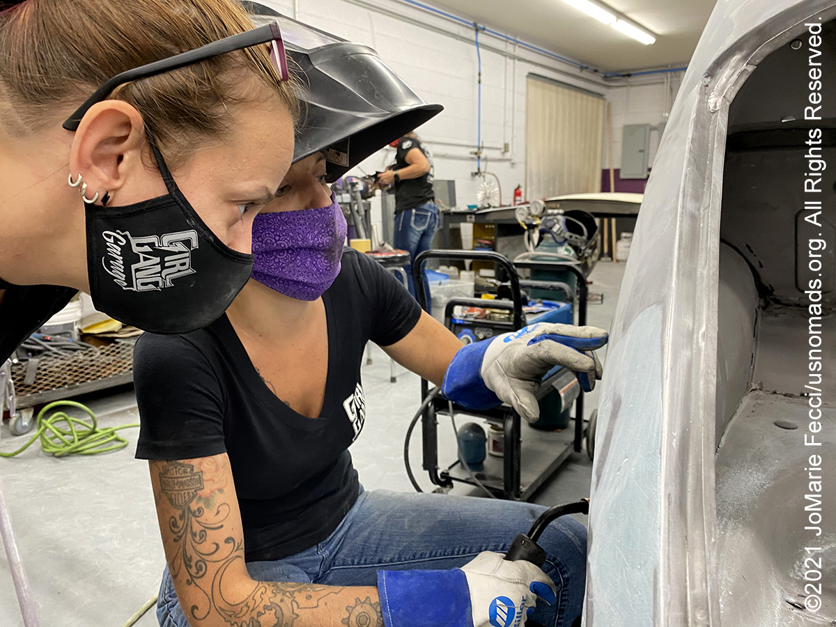
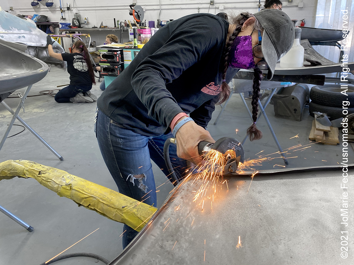
Returning to the Phoenix area for the last time to participate in a Girl Gang Garage event and attend another session of the Ladies Offroad Network Skills Camp. This edition of the Skills Camp is called “5+” because the trails are all “rated” five or higher on a difficulty scale of 1-10, meaning it is designed for more experienced drivers and bigger more capable Jeeps. (Click through the images below for each day’s notes)…

Note this map provides an overview of the ninth segment of the journey–around Phoenix area and the various trailheads. The route on this map shows the overall direction of travel and key “stops” but does not include any detailed GPX tracks for backcountry trails, etc…
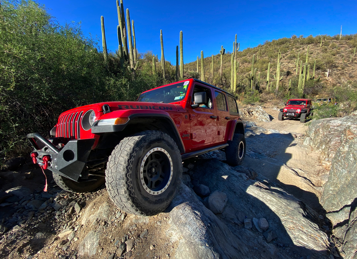
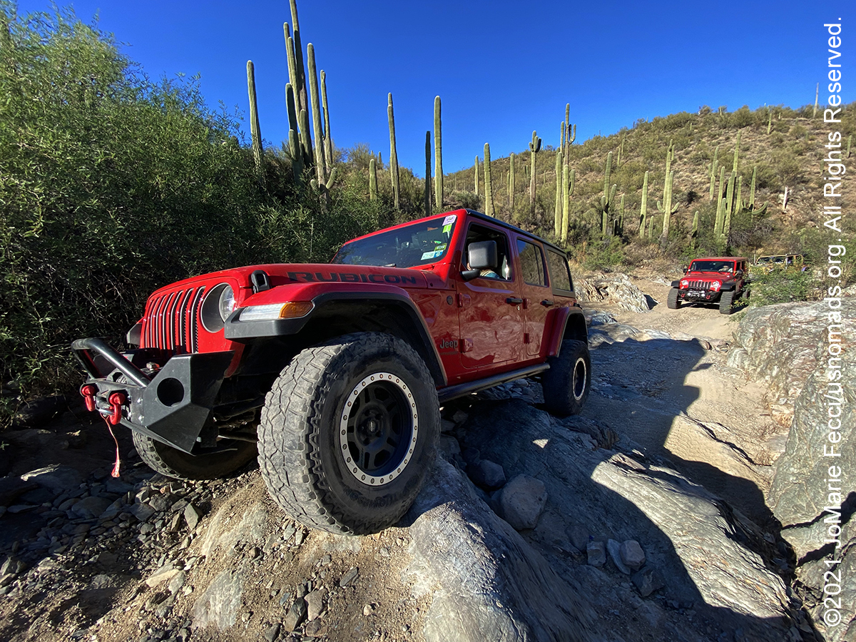
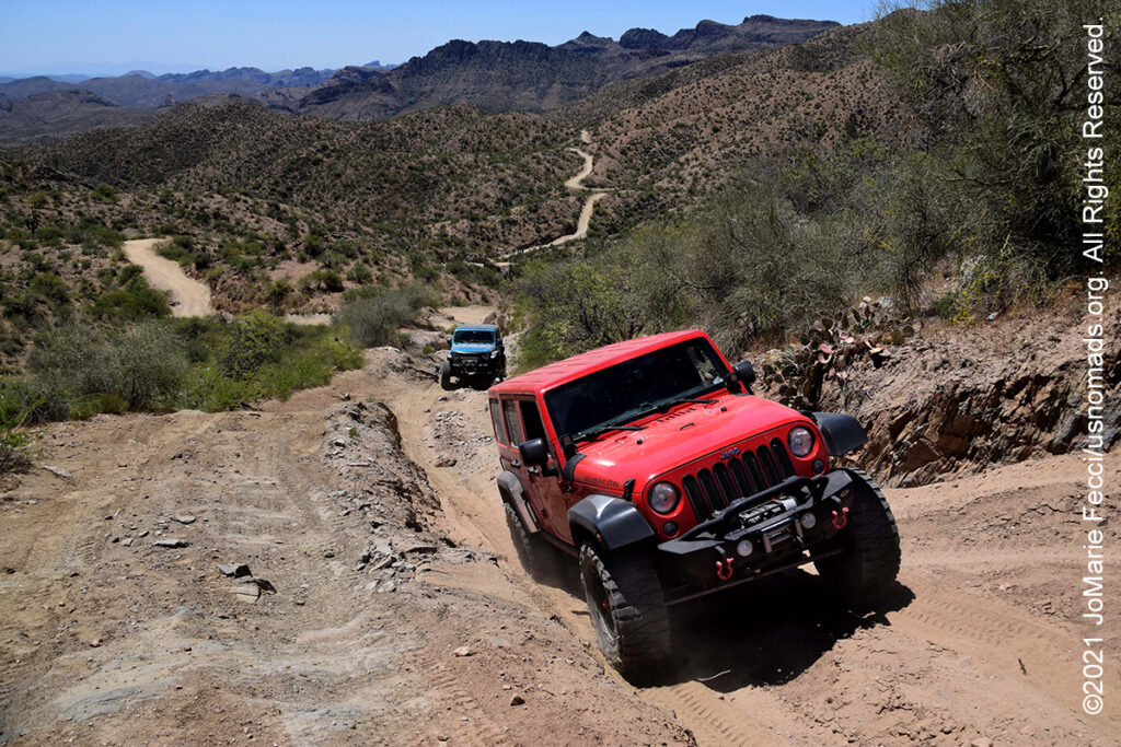
The Table Mesa trails lie just north of Phoenix metro near the foothills of the Bradshaw Mountains. This area started to be known as a rockcrawling destination in the late 1990s, and it remains popular to this day. Like many rockcrawling places in the Sonoran Desert, trails consist largely of sandy washes with boulders and waterfall ledges. Some years back, the Bureau of Land Management (BLM) created a public use plan for this area, dividing portions up for use by off-roaders, mountain bikers, hikers, and target shooters. Now, there are a handful of legal trails in the area designated by BLM as Technical Vehicle trails. These trails are marked with a special prefix “TV,” which stands for “Technical Vehicle.” One of the more popular technical trails is “Terminator”, which has two parts, lower TV-2 and upper TV-3. These trails are typically run one way and the Table Mesa area is well marked. The trails are difficult through a narrow, rocky wash with tight turns and huge obstacles. Winch, lockers, and 35″ tires are recommended. Experienced drivers only.
The Prescott National Forest is a 1.25 million-acre forest is located in a mountainous section of central Arizona between forested plateaus to the north and arid desert to the south. Portions of the Prescott National Forest today are much the same as they were when Sam Miller panned for gold in Lynx Creek and was wounded by a cougar, or when General Crook’s flag fluttered over Palace Station. At the lowest elevation, the primary vegetation is of the Sonoran Desert type. As the elevation rises, chaparral becomes common, followed by piñon pine and juniper. Above that, Ponderosa pine dominates the landscape.
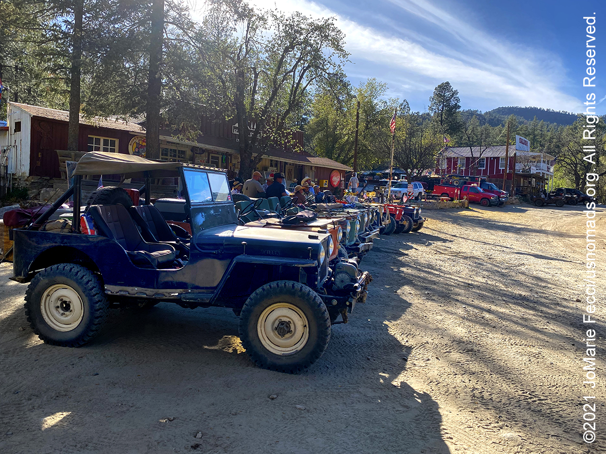
The Backway to Crown King is a 26 mile offroad journey from Lake Pleasant to the old mining town of Crown King. This challenging trail includes optional obstacles, old mines, and great views on a climb up into the Prescott National Forest. The trail starts in an area that passes through sections of residential private property before it narrows as it begins to climb and wind its way north to Crown King. Most of the route is easy to moderate, however there are a few difficult places that will challenge stock vehicles. Most of the obstacles along the way have bypasses. The highlight of the trail is actually the town itself. It is well worth the time to check out the general store, saloon, and prospector mall. There are also several cabins in the area that are available for travelers to spend the night.
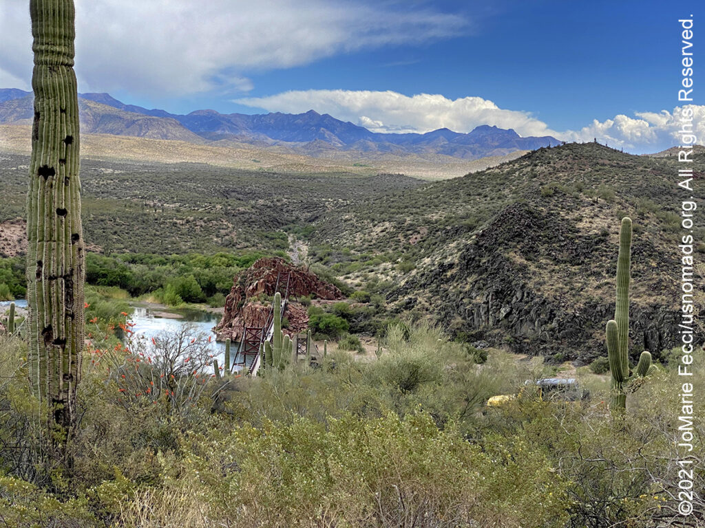
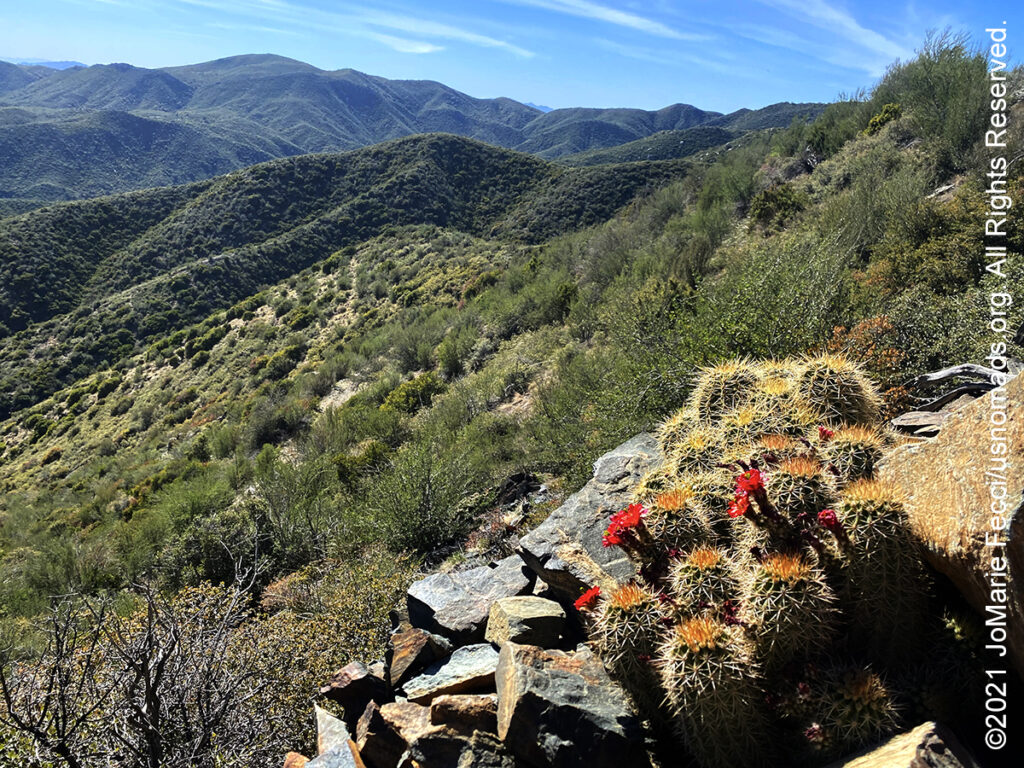
The Tonto National Forest, encompassing 2,873,200 acres, is the largest of the six national forests in Arizona and is the fifth largest national forest in the United States. The Tonto features some of the most rugged and inherently beautiful land in the country. Sonoran Desert cacti and flat lands slowly give way to the highlands of the Mogollon Rim. This variety in vegetation and range in altitude — from 1,300 to 7,900 feet — offers outstanding recreational opportunities throughout the year, whether it’s lake beaches or cool pine forest. With a southern boundary near the Phoenix metropolitan area, Tonto is also the most visited “urban” forest in the United States. One of the primary purposes for establishing the Tonto National Forest in 1905 was to protect its watersheds around reservoirs. The forest produces an average of 350,000 acre-feet of water each year. Six major reservoirs on the forest have the combined capacity to store more than 2 million acre-feet of water. Management efforts are directed at protecting both water quality and watershed and riparian area conditions.
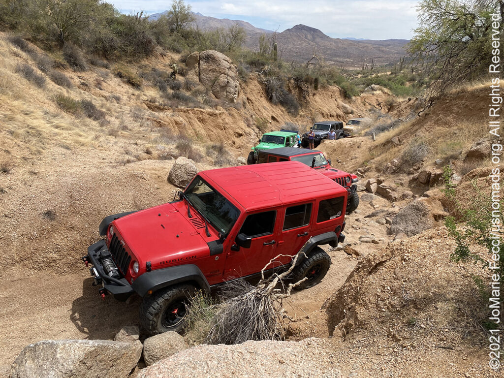
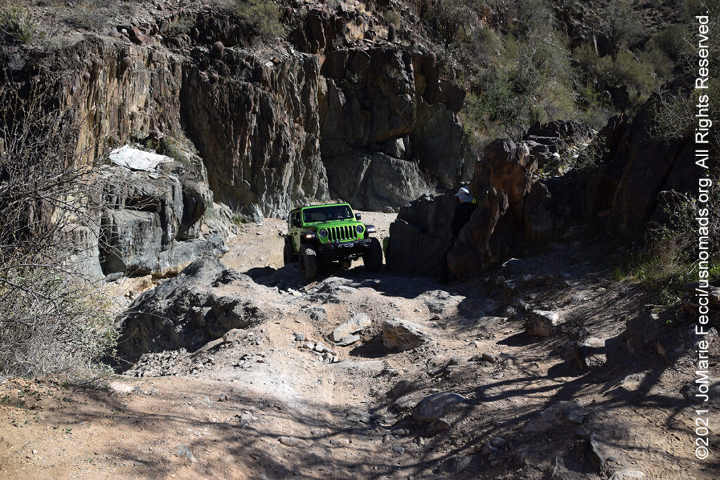
Rocker Panel Pass is a difficult rock crawling trail within the Tonto National Forest. Drivers will experience the best scenery this area has to offer with views of Mt. Ord, the Four Peaks Wilderness Area, Sycamore Creek, Weaver’s Needle, and the Superstition Wilderness Area. The earlier sections of the trail offer a reprieve in the summer months where the water is cool and the shade is plentiful. A big portion of the areas flora can also be found here including paloverde and mesquite trees, saguaro cactus, teddy bear cholla cactus, prickly pear cactus, ocotillo shrub, brittle bush, and the jojoba bush. The section of FR 160, known as Rocker Panel Pass, has numerous large boulders and rock ledges that require a modified vehicle and a good spotter. Once out of the “pass” the trail connects to Sycamore Creek Loop and will loop back to the highway a few miles south of the starting point.