(Part 11)

100 Days Journey: Part 11 – Leaving the West
From Utah and Colorado I headed north into Wyoming via the Flaming Gorge National Recreation Area to Rock Spring where I paused to check out the Red Desert. Savoring a last few days of sand dunes and buttes, as I slowly work my way to the transition away from “the west” somewhere around the 100th Meridian in Nebraska. (Click through the images below for each day’s notes)…
Note this map provides an overview of the eleventh segment of the journey–from Grand Junction, Colorado north to Wyoming, and then east across Nebraska and Iowa. The route on this map shows the overall direction of travel and key “stops” but does not include any detailed GPX tracks for backcountry trails, etc…
The Tabegauche trail was created by the Colorado Plateau Mountain Bike Trail Association built in 1990, as a 142-mile bike route from Montrose to Grand Junction. In 2018, the Bureau of Land Management Grand Junction Field Office officially opened the Tabeguache Connector Trail which allows motorized vehicles to follow the Tabeguache Trail from the Bangs Canyon trailhead near Grand Junction to Montrose, Colo. The 4×4 version of the trail bypasses any sections of single-track, allowing 4WD vehicles an opportunity to run this beautiful route. The area of Colorado on the Uncompahgre Plateau, was originally inhibited by the Tabeguache Utes, who were nomadic, moving from camp to camp to exploit nearby food sources. The modern spelling is from a word coined by the explorer Escalante in 1776, meaning “place where the snow melts first”. Over the last 100 years, the Uncompahgre Plateau has been the scene of vast cattle grazing, sheepherding, mining & lumber ventures. The landscape is dotted with evidence of these past and present uses.
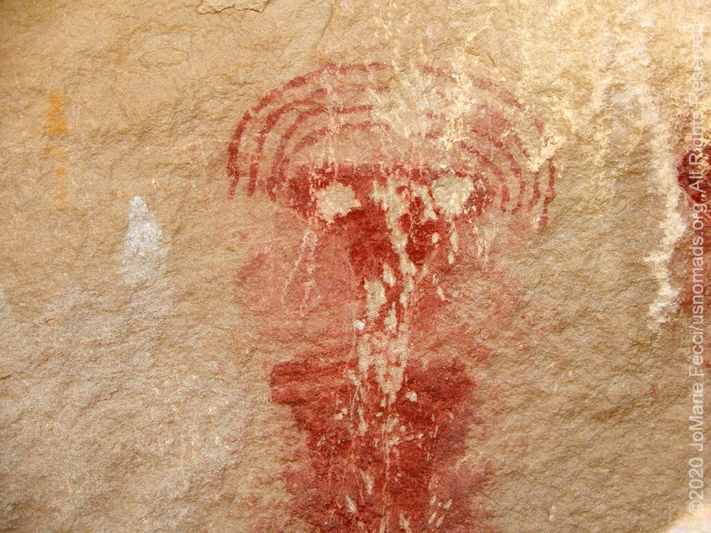
Canyon Pintado National Historic District encompasses over 16,000 acres of public land along 15 miles of State Highway 139. Canyon Pintado (Spanish for “Painted Canyon”) received its name in 1776 when Fathers Dominguez and Escalante noted numerous examples of ancient Native American rock art as they traveled through the Douglas Creek Valley. There are hundreds of archaeological sites within the district, mostly deriving from the prehistoric Fremont Culture (prior to 1300 AD) and the historic Ute (1300-1881 AD) occupations of the Douglas Creek canyon. The rock art sites stretch along the highway, and consist of the South Orientation site and 8 other developed and partially developed sites and interpretive exhibits.
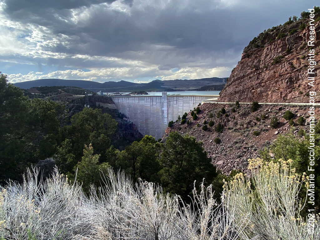
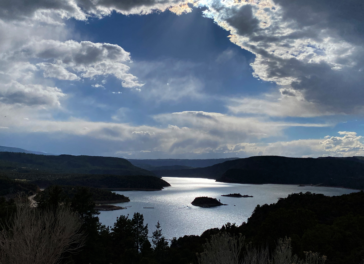
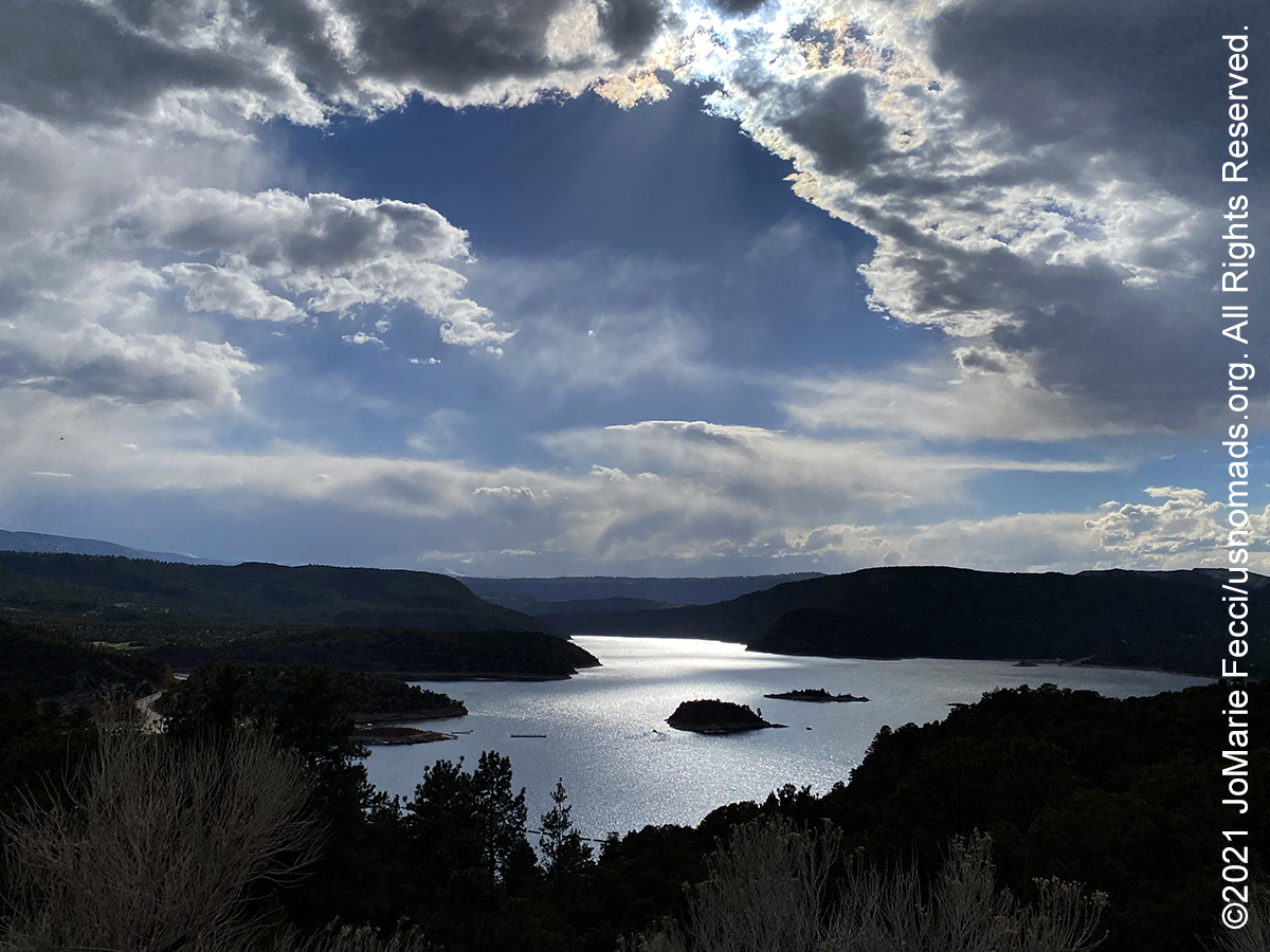
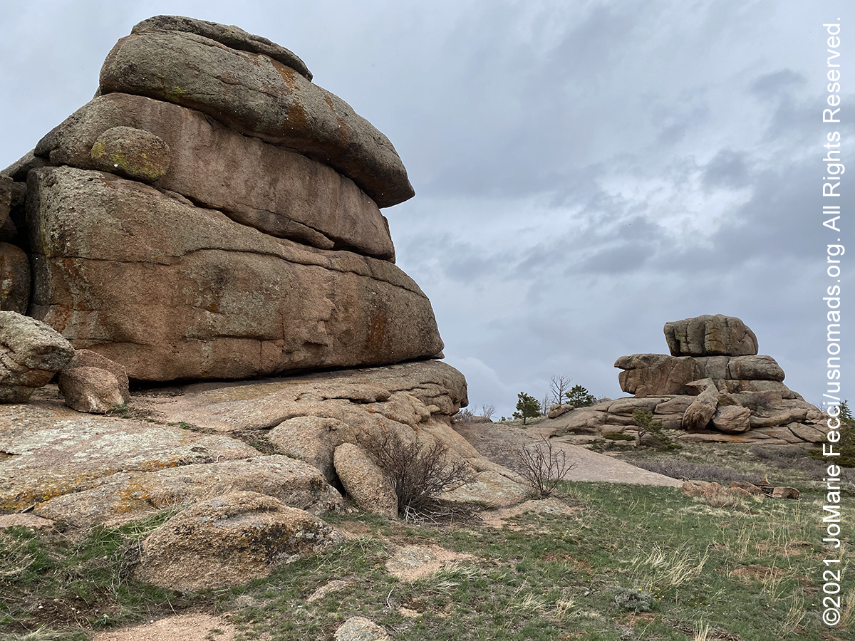
Flaming Gorge was named by John Wesley Powell in 1869 after he and his men saw the sun reflecting off of the red rocks at the start of their daring exploration of the Green and Colorado Rivers. Today the steep-narrow gorge on the Green River contains the Flaming Gorge Reservoir, the largest reservoir in Wyoming. The Flaming Gorge Dam was built in 1964, and the reservoir straddles the Utah-Wyoming border, with the larger part on the Wyoming side. The foundation of the reservoir is a steep-sided narrow canyon composed of siliceous sandstone and hard quartzites inter-bedded with softer shales, siltstones, and argillites. Visitors enjoy hiking, boating, fishing, windsurfing, camping, backpacking, cross-country skiing, and snowmobiling within Flaming Gorge National Recreation Area, which is operated by Ashley National Forest. Petroglyphs and artifacts suggest that Fremont Indians hunted game near Flaming Gorge for many centuries. Later, the Comanche, Shoshoni, and Ute tribes, whose members spread throughout the mountains of present-day Colorado and Utah, passed through the Flaming Gorge country.
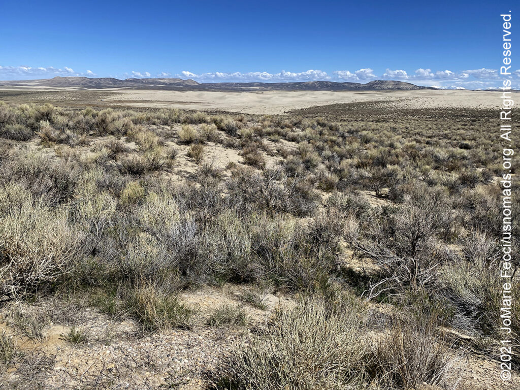
The Red Desert is a high altitude desert and sagebrush steppe located in south central Wyoming, comprising approximately 9,320 square miles. Among the natural features in the Red Desert region are the Great Divide Basin, a unique drainage basin formed by a division in the Continental Divide, and the Killpecker Sand Dunes, the largest living dune system in the United States. Scientists trace the story of human presence in the Red Desert back 12,000 years. Evidence of early human inhabitants is seen in rock art found at the Boars Tusk, East Flaming Gorge, and Seedskadee areas. Other pre-historic evidence include Native American artifacts estimated to be more than 10,000 years old found in the Killpecker Sand Dunes, often in company with bison bones. The Red Desert region served as a marketplace and crossroads of interaction between nomadic Plains Indians, including Blackfeet, Crows, and Shoshone into the historical period. In the 19th century, the Oregon, California and Mormon Trails crossed the Continental Divide at South Pass, just north of the Red Desert. Generations of American families left their mark upon the desert as they migrated westward along emigrant trails. The majority of the Red Desert is public land managed by the Rock Springs and Rawlins field offices of the U.S. Bureau of Land Management (BLM). The region is rich in oil, natural gas, uranium, and coal. An estimated 84% of the Red Desert has been “industrialized” by oil and gas drilling or by mining operations and associated roads. Nearly three-quarters of the area is covered by sagebrush grassland. Home to the largest unfenced area in the continental United States, the Red Desert supports an abundance of wildlife, despite its scarcity of water and vegetation. The largest migratory herd of pronghorn in the lower 48 states and a rare desert elk herd, said to be the world’s largest, live in the desert. Herds of feral horses roam the area in large numbers.
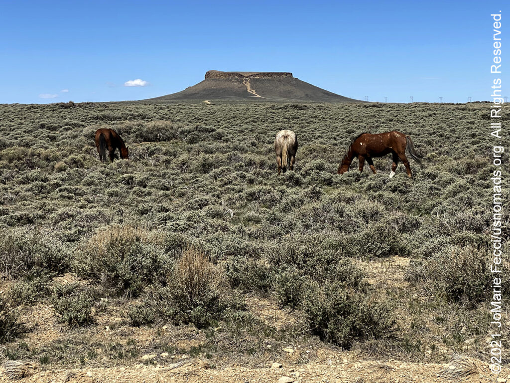
Pilot Butte is located directly on top of White Mountain, and was named by early travelers in the region as a signal that they were close to the Green River. At 7,949 feet in elevation at its highest point, the butte is the second highest point in the immediate region, the first being Aspen Mountain to the south. The area around Pilot Butte is home to several herds of wild horses and there is a “self-guided wild horse loop” along a 24-mile dirt road that goes through the range.
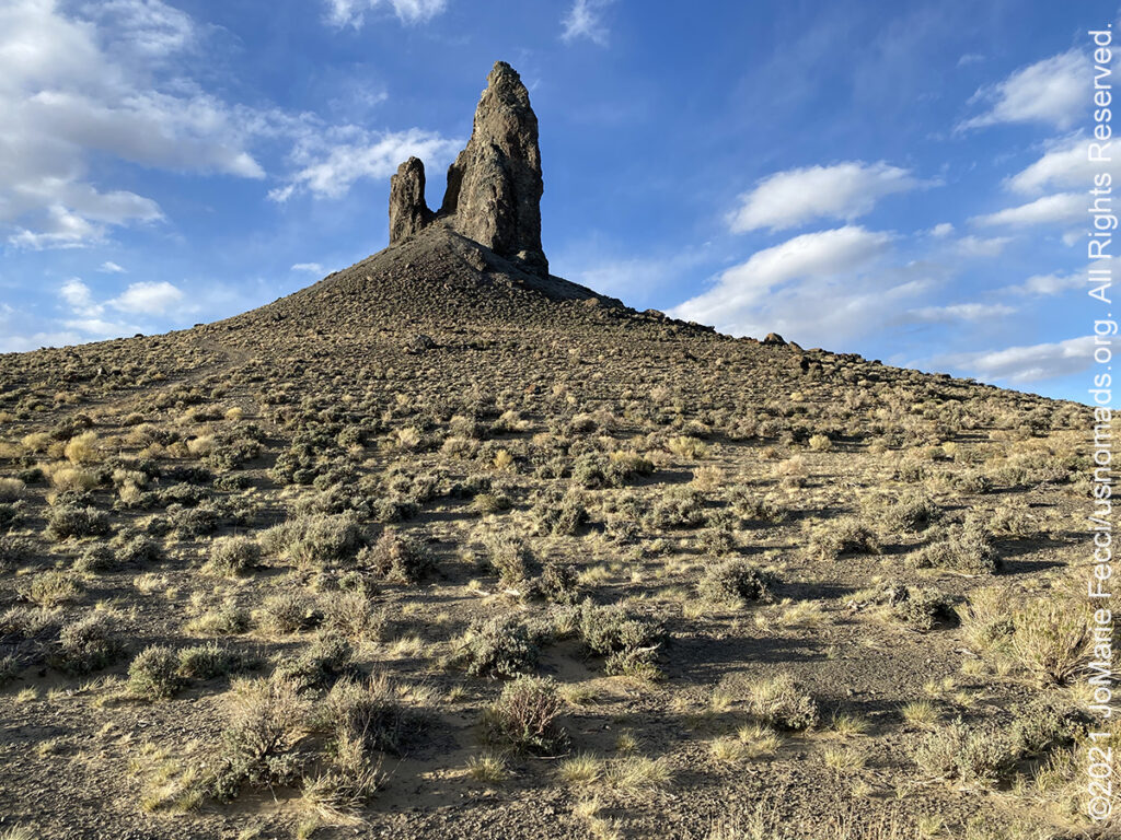
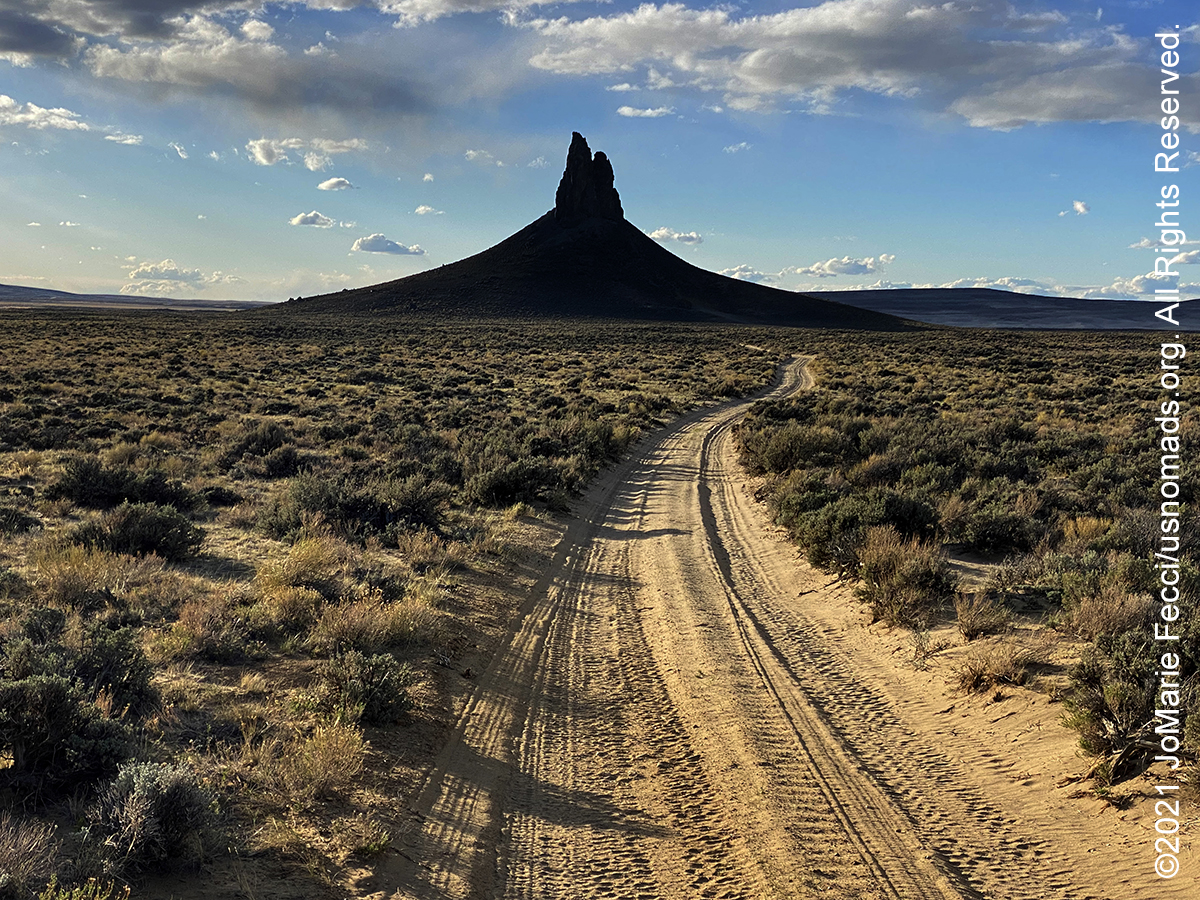
Boar’s Tusk is an isolated remnant of a volcano within the Rock Springs Uplift in the Green River Basin of southwestern Wyoming. It has a peak elevation of 7,101 ft and rises some 400 ft above the surrounding Killpecker Creek plain. The unique formation is all that remains of the long extinct volcano associated with the Leucite Hills to the east. Heavily eroded, it is part of the volcanic neck which is composed of the uncommon rock lamproite. The lamporite of Boar’s Tusk dates back 2.5 million years. Boar’s Tusk is the most prominent feature within a sacred cultural landscape of importance to Native American Tribes. The archaeological record of the area includes a number of rock art sites, several important Paleoindian sites, the Eden-Farson site which is a Late Prehistoric/Protohistoric campsite associated with a large pronghorn processing area, and a historic (and perhaps older) Indian trail network. A high-clearance four-wheel drive vehicle is recommended for the deeply rutted, very sandy two track that runs up to the base of the tusk. A hiking trail circles the tusk and a steep route climbs the base.
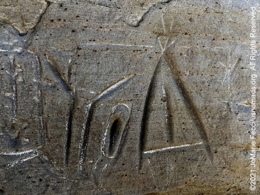
The White Mountain Petroglyphs site contains hundreds of carved figures that range from 200 to 1000 years old. Etched into the sandstone bedrock of the Ecocene Bridger formation some 1,000 to 200 years ago, several figures appear to portray bison and elk hunts while others depict geometric forms or tiny footprints. The petroglyphs also include drawings of horses and riders with feather headdresses, teepees and several kinds of human figures. Contemporary Native American spiritual leaders believe these drawings were created for religious purposes and should be treated accordingly. Somewhat unique to this site are handprints worn into the rock as well, providing visitors with a compelling connection to those who used the site long ago. Some theorize that this area may have been a birthing place for the Plains and Great Basin native American people based on several of the drawings that depict animals within animals. It is possible that the handholds worn in the stone may have served for generations of women to grip the rock during labor. The site remains a sacred place for the Native American people, and visitors are asked to view the petroglyphs with reverence befitting their spiritual significance…
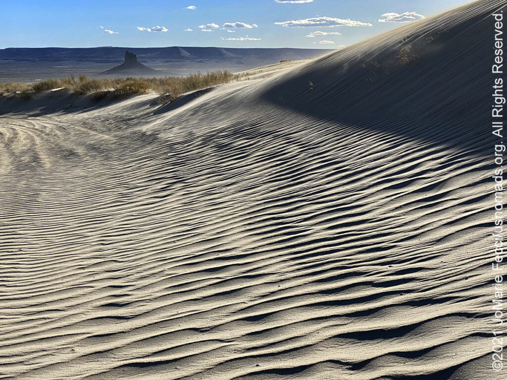
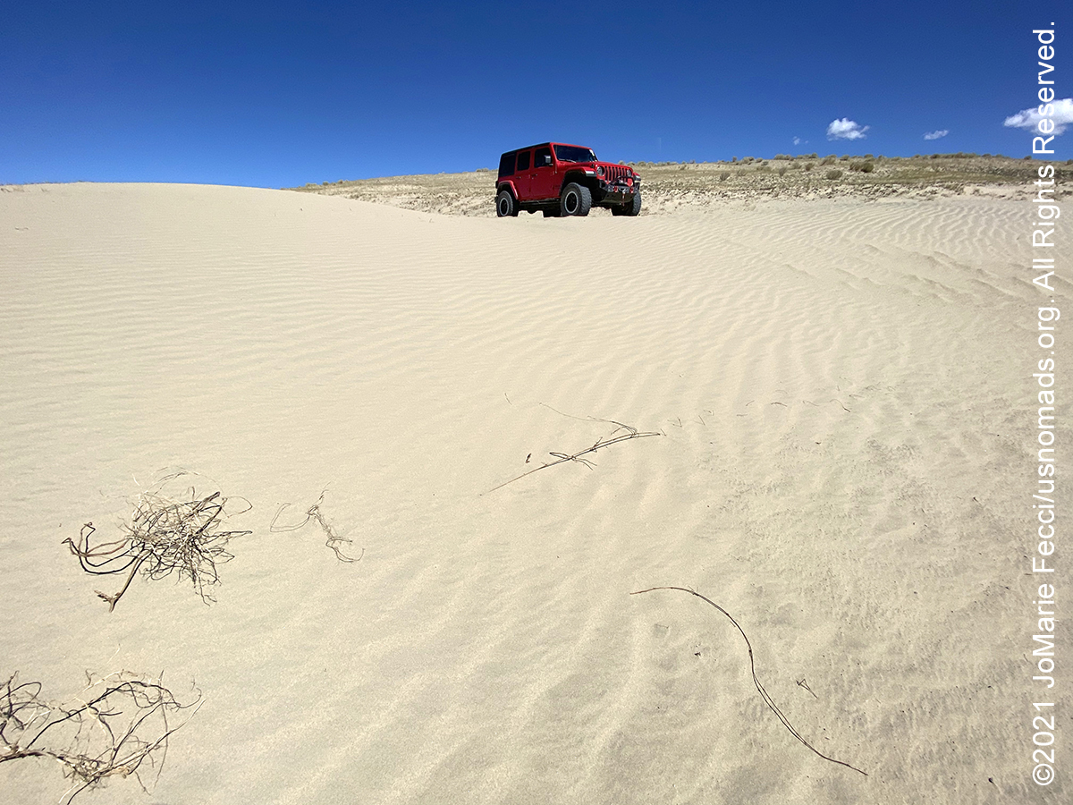
Killpecker Sand Dunes, encompassing approximately 109,000 acres, stretches 55 miles east from the Green River Basin across the Continental Divide into the Great Divide Basin making it the second largest active sand dune field in the world. The sprawling dunes may seem out of place in Wyoming, but the dune field exists here because a gap between southwestern Wyoming’s Leucite Hills funnels the prevailing westerly winds which become strong enough to carry sand and gravel. As the winds blow through the Leucite Hills, the sand collects in large dunes can that reach heights of over 100 feet and run for over 100 miles from west to east. Boar’s Tusk, the core of an ancient volcano, rises straight out of the ground and seemingly guards the shifting sand, windblown into waves and ripples and huge swells like a beach in search of a sea. Between the dunes are basins of grasses and occasional pools of snowmelt. The western portion of the dune field is managed as wilderness. The eastern portion is the “open play area.” The designated OHV area includes 11,000 acres that run the gamut from the smaller dunes to mammoth dunes that reach 100 feet high. The dunes are named after Killpecker Creek, the drainage that flows south from the dunes to Rock Springs. Legend tells of soldiers assigned to protect the Overland Stage station in the 1860s who drank the salty water of the creek, then called the Kilpatrick. When they discovered their virility had been compromised, they renamed it Kill Pecker creek.
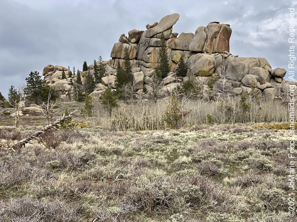
Vedauwoo is a group of spectacular granite rock formations rising out of the thin soils on Pole Mountain located between Laramie and Cheyenne in southeastern Wyoming. The ancient rock formations, created by ice, wind and water, seem to defy gravity rising up to 500 feet in the air. The Native Americans named this area Vedauwoo, which means “Land of the Earthborn Spirits.” Local legend says the rocks were piled up by playful spirits and later the many nooks and crannies served as hideouts for western outlaws evading capture. These same rocks now offer sanctuary for outdoor enthusiasts. Vedauwoo is considered one of the best places to rock climb in Wyoming, and there are many places to practice crack climbs. The 1.4 billion year old Sherman granite rocks are made of pink feldspar, white quartz, black specs of horneblende and other minerals such as mica. The hoodoos and outcrops represent some of the oldest rock in Wyoming, and are exposed at the surface around Vedauwoo due to the uplift of the Laramie Mountains that began around 70 million years ago. Younger layers of rock and sediment have progressively eroded, and this continues today. The hard granite is more erosion-resistant, resulting in the wind and water-sculpted forms. At an altitude of 8,200 feet, the views from the top of these formations overlook dense pine directly below and endless plains under the wide open Wyoming skies. It is a place of profound beauty. There are many hiking trails in the area and the Turtle Rock trail starts directly from the 28-site campground and winds its way between multiple rock formations while passing meadows, streams, beaver ponds and forested areas. In addition to the campground, there are 97 designated dispersed campsites tucked back on Forest Service Road 700.
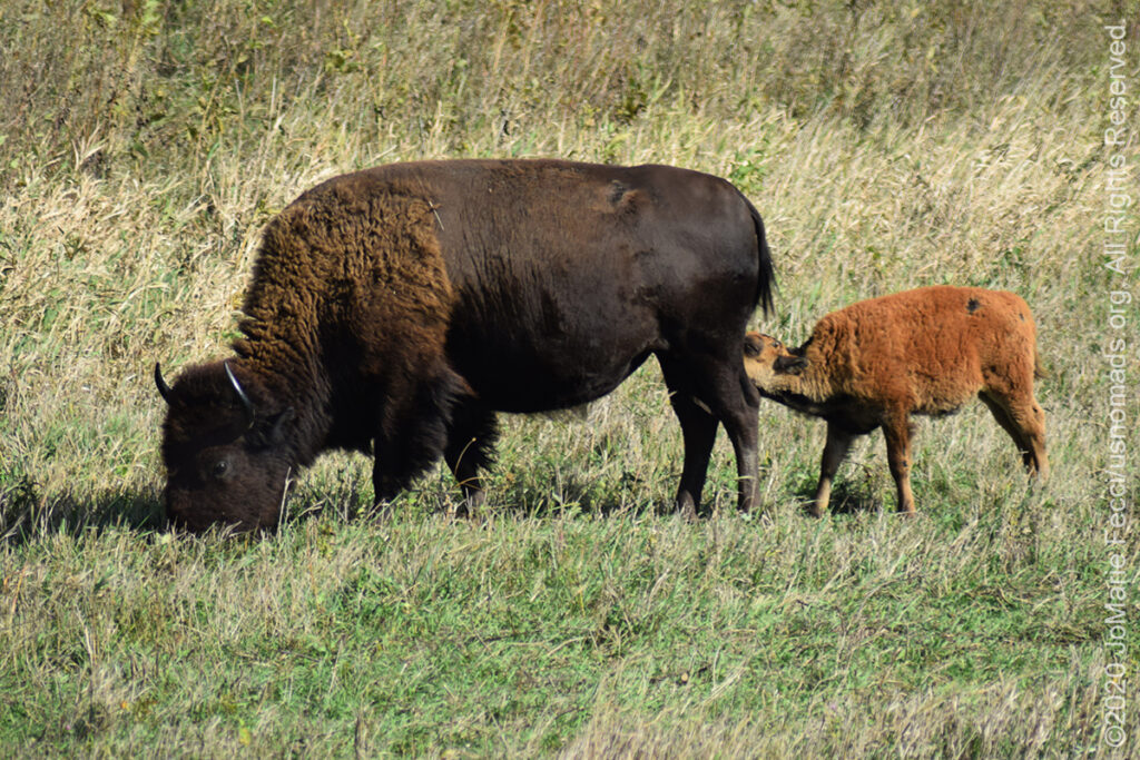
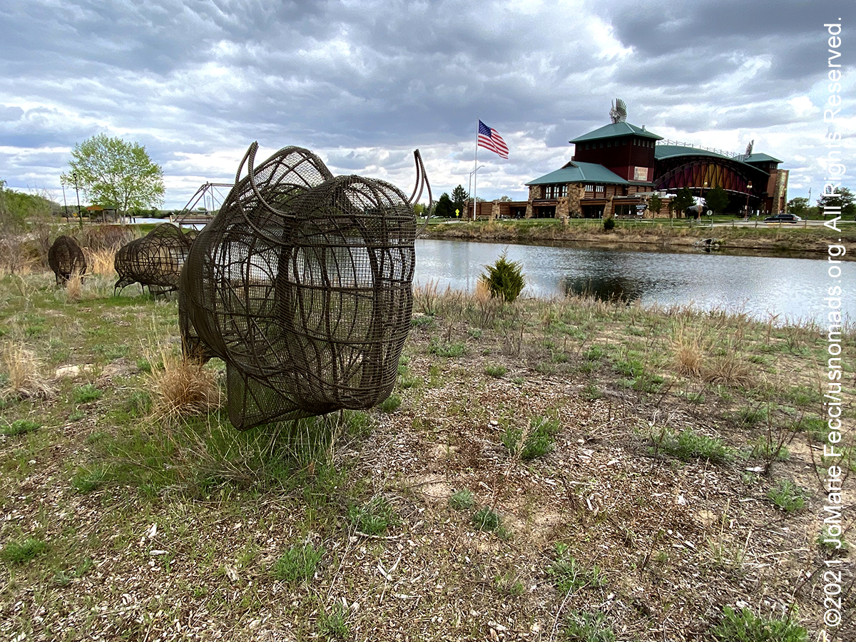
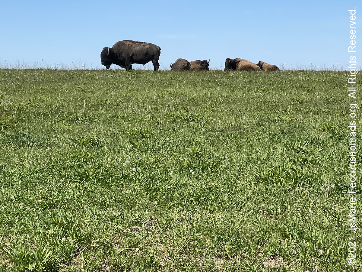
The Neal Smith National Wildlife Refuge is a federal national wildlife refuge located in Jasper County, Iowa. The refuge seeks to restore the tallgrass prairie and oak savanna ecosystems that once covered most of Iowa. The core of the Neal Smith refuge was a 3,600-acre block of land originally acquired by Iowa Power and Light for a nuclear power plant. The Fish and Wildlife Service was able to acquire this land in 1990. Although the Neal Smith refuge includes a patchwork of small and seriously degraded native prairies, most of the refuge is the result of prairie restoration or reconstruction efforts. The restoration work has been done with local ecotype seed harvested from nearby native prairie remnants or from other restoration efforts that have used acceptable local ecotype seed. The refuge has a herd of approximately 50 buffalo and 20 elk. The American bison, also commonly called buffalo, once numbered in the millions, and the nomadic herds roamed great distances across the North American prairies. During the 19th century when the great plains were being settled, their populations were decimated. Beginning in the early 20th century, conservation herds were established to re-build the populations and prevent extinction. Neal Smith NWR manages one of these conservation herds which lives in an 800-acre management area. The bison can sometimes be seen on the scenic drive route or from the Tallgrass and Overlook Trails.
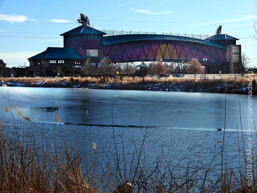
The Archway, formally known as “The Great Platte River Road Archway Monument” is a monument on Interstate 80 located three miles east of Kearney, Nebraska. The monument museum offers an interpretive experience that tells the story of Nebraska and the Platte River Valley in the historical development of the United States. Since prehistoric times, the trail along the Platte River through Nebraska, which came to be known as the Great Platte River Road, has been a thoroughfare for travel across the continent. The Archway museum details the stories of the pioneers, adventurers, and innovators who have traveled the trail since the mid-1800s. The exhibit starts at Fort Kearny in 1848 and features sections on the Oregon Trail, California Trail, and Mormon Trail that converged at the nearby Fort Kearny before heading west. As visitors progress through the exhibit, the displays of different time periods feature a prairie schooner wagon on the Oregon Trail, a buffalo stampede, the Mormon Handcart Expedition, a 49er’s campsite, the Pony Express, the Transcontinental Telegraph, a stagecoach, the Transcontinental Railroad, the first transcontinental highway, the Lincoln Highway, and today’s transcontinental highway, I-80. The exhibit ends with a replica drive-in and 1950s-style cafe with windows providing views over the interstate. The exhibits are featured in chronological order and reflect the historical developments that occurred on the Great Platte River Road. The monument spans more than 300 feet above Interstate 80, and in addition to the museum, the site includes several attractions and a hike/bike trail.